|
search place name
|
||
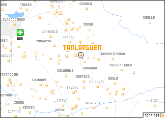
Tanlarguen (Kadiogo, Burkina Faso)Tanlarguen is a town in the Kadiogo region of Burkina Faso. An overview map of the region around Tanlarguen is displayed below.
regional and 3d topo map of Tanlarguen, Burkina Faso ::
Tanlarguen airports ::
The nearest airport is OUA - Ouagadougou, located 15.0 km north west of Tanlarguen.
Nearby towns ::
Ouassoudi (0.8km south east) //
Sogoden (1.2km north west) //
Ouélinwissen (1.2km east) //
Tanlarkouri (1.8km north west) //
Tangséga (1.9km north west) //
Gounguen (2.2km north east) //
Yogbogo (2.6km north) //
Goguen (2.7km east) //
Séloguen (2.7km north) //
Koulibéré (2.9km north east) //
Roumen (3.5km north) //
Péodogo (3.6km east) //
Kossodo (3.6km west) //
Badnogo II (3.8km south east) //
Mogden (3.9km north) //
Sogoden (3.9km north west) //
Nagren (4.2km north east) //
Samben (4.8km north west) //
Kouékembissiga (5.1km north) //
Mogtédo (5.1km south) //
Kouila (5.1km west) //
Kalgondé (5.2km south west) //
Zétégomdé (5.3km west) //
Oiudtenga (5.5km west) //
Tanguen (6.1km north east) //
Napagabtenga Goungen (6.4km south) //
Zaken (6.9km north) //
Tansobentenga (6.7km east) //
Tamsen (6.9km north) //
[all distances 'as the bird flies' and approximate]  Places with similar names to Tanlarguen, Burkina Faso :: Disclaimer :: Information on this page comes without warranty of any kind |
||
|
Where is Tanlarguen? Elevation and coordinates ::
Latitude (lat): 12°17'57"N Longitude (lon): 1°23'8"W
Elevation (approx.): 304m (map arrows pan, magnifying glasses zoom) |
||
|
Visiting Tanlarguen? Hotel/Accommodation ::
Book a hotel in Tanlarguen Travel Guide ::
rental cars ::
car rental offers GPS waypoint ::
download a GPX waypoint (PoI) of Tanlarguen for your GPS receiver
|
||