|
search place name
|
||
Timanéboen (Bazèga, Burkina Faso)Timanéboen is a town in the Bazèga region of Burkina Faso. An overview map of the region around Timanéboen is displayed below.
regional and 3d topo map of Timanéboen, Burkina Faso ::

Timanéboen airports ::
The nearest airport is OUA - Ouagadougou, located 36.5 km north of Timanéboen.
Nearby towns ::
Sakpelsé (1.0km north west) //
Nabitenga (1.3km north east) //
Goroguen (1.5km north east) //
Gorouré (1.8km south west) //
Koaken (1.9km east) //
Tanlilli (1.9km north east) //
Koagma (2.0km east) //
Tanguen (2.3km north east) //
Saponé (2.8km north west) //
Nabitenga (3.1km west) //
Yougoupélé (3.7km north east) //
Kologonaba (3.9km north west) //
Bonogo (3.9km north) //
Kouken (4.0km south west) //
Ouidi (4.0km north west) //
Goden (4.0km south west) //
Bogodogo (4.1km east) //
Yakin (4.3km south east) //
Komsilga (4.5km east) //
Bagamnini (4.7km south east) //
Damkiéta (4.9km west) //
Zanguen (4.9km east) //
Kodogo (5.2km north) //
Rabinsma (5.3km west) //
Tougoulema (5.4km south) //
Babédo (5.4km south) //
Siguinvoussé (5.4km north east) //
Ouidi (5.5km north) //
Koumsaga (5.5km east) //
[all distances 'as the bird flies' and approximate] 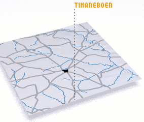 Places with similar names to Timanéboen, Burkina Faso ::
// Teminabuan (ID)
Disclaimer :: Information on this page comes without warranty of any kind |
||
|
Where is Timanéboen? Elevation and coordinates ::
Latitude (lat): 12°1'55"N Longitude (lon): 1°35'22"W
Elevation (approx.): 331m (map arrows pan, magnifying glasses zoom) |
||
|
Visiting Timanéboen? Hotel/Accommodation ::
Book a hotel in Timanéboen Travel Guide ::
rental cars ::
car rental offers GPS waypoint ::
download a GPX waypoint (PoI) of Timanéboen for your GPS receiver
|
||