|
search place name
|
||
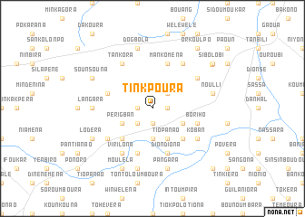
Tinkpoura (Burkina Faso)Tinkpoura is a town in Burkina Faso. An overview map of the region around Tinkpoura is displayed below.
regional and 3d topo map of Tinkpoura, Burkina Faso ::
Tinkpoura airports ::
The nearest airport is BOY - Bobo-dioulasso Bobo Dioulasso, located 149.8 km north west of Tinkpoura.
Nearby towns ::
Niagbalandoura (1.8km west) //
Sianko (1.9km south) //
Poloukpara (1.8km east) //
Tokéra (2.6km south west) //
Kaldéra (2.6km north east) //
Kama (3.7km south) //
Périgban (4.1km south west) //
Tiopanao (4.1km south east) //
Bolougban (4.1km south east) //
Bondouména (5.2km south west) //
Polanko (5.2km south east) //
Arakora (5.9km south) //
Boriho (5.8km east) //
Sompora (5.8km west) //
Mankoména (5.9km north) //
Diondiona (5.9km south) //
Koban (6.6km south east) //
Nionion (6.6km north east) //
Gongorona (6.6km south west) //
Virilona (6.6km south west) //
Tankora (6.6km north west) //
Bouli (6.6km north east) //
Langara (7.3km west) //
Koursiéra (7.6km south) //
Dogbola (7.6km north) //
Noulli (7.5km east) //
Pangara (7.6km south) //
Sounsouna (8.2km north west) //
Lodéra (8.2km south west) //
[all distances 'as the bird flies' and approximate]  Places with similar names to Tinkpoura, Burkina Faso ::
Disclaimer :: Information on this page comes without warranty of any kind |
||
|
Where is Tinkpoura? Elevation and coordinates ::
Latitude (lat): 10°15'0"N Longitude (lon): 3°19'0"W
Elevation (approx.): 318m (map arrows pan, magnifying glasses zoom) |
||
|
Visiting Tinkpoura? Hotel/Accommodation ::
Book a hotel in Tinkpoura Travel Guide ::
rental cars ::
car rental offers GPS waypoint ::
download a GPX waypoint (PoI) of Tinkpoura for your GPS receiver
|
||