|
search place name
|
||
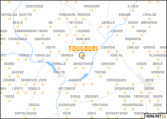
Tougouri (Burkina Faso)Tougouri is a town in Burkina Faso. An overview map of the region around Tougouri is displayed below.
regional and 3d topo map of Tougouri, Burkina Faso ::
Tougouri airports ::
The nearest airport is OUA - Ouagadougou, located 92.1 km south of Tougouri.
Nearby towns ::
Wésentenga (1.9km south) //
Kougouri (2.6km south west) //
Bissigui (2.6km north west) //
Tamniga (3.6km west) //
Boulli (3.6km west) //
Oualaga (3.7km north) //
Toéssé (5.2km south east) //
Légouré (5.6km north) //
Sian (5.6km south) //
Sébila (5.6km south) //
Kirigtenga (5.8km north) //
Rahalla (5.7km west) //
Damèsma (5.7km east) //
Sidouré (5.8km south) //
Zorkoum (5.7km east) //
Diguila (5.7km west) //
Goulouguen (5.8km south) //
Namsiguia (6.6km north west) //
Chalro (6.6km south west) //
Arouesma (6.6km south west) //
Koulto (7.2km east) //
Zouta (7.5km west) //
Tibtenga (7.6km north) //
Delga (7.5km east) //
Zimidou (7.8km north west) //
Wintobaka (8.2km south west) //
Dèm (8.2km north east) //
Komsilga (9.2km south west) //
Gantodro (9.2km south east) //
[all distances 'as the bird flies' and approximate] 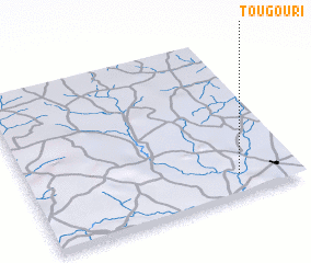 Places with similar names to Tougouri, Burkina Faso ::
Disclaimer :: Information on this page comes without warranty of any kind |
||
|
Where is Tougouri? Elevation and coordinates ::
Latitude (lat): 13°8'0"N Longitude (lon): 1°13'0"W
Elevation (approx.): 339m (map arrows pan, magnifying glasses zoom) |
||
|
Visiting Tougouri? Hotel/Accommodation ::
Book a hotel in Tougouri Travel Guide ::
rental cars ::
car rental offers GPS waypoint ::
download a GPX waypoint (PoI) of Tougouri for your GPS receiver
|
||