|
search place name
|
||
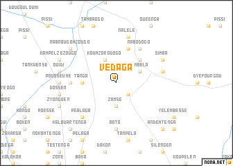
Védaga (Burkina Faso)Védaga is a town in Burkina Faso. An overview map of the region around Védaga is displayed below.
regional and 3d topo map of Védaga, Burkina Faso ::
Védaga airports ::
The nearest airport is OUA - Ouagadougou, located 124.7 km west of Védaga.
Nearby towns ::
Doundoudougou (2.6km south east) //
Zamsé (3.7km south) //
Koumzorodogo (4.1km north west) //
Tambéla (4.1km north east) //
Kouapkouka (5.2km north east) //
Tanga (5.4km west) //
Koboundouen (5.8km north) //
Nabodogo (6.6km north east) //
Bonéssen (6.6km north east) //
Gonsen (7.2km west) //
Boto (7.4km south) //
Nalélé (7.6km north) //
Siguinoré (7.5km east) //
Péalaga (7.8km south west) //
Simba (8.1km north east) //
Nabnougomzougo (9.1km north west) //
Kalouartenga (10.4km south west) //
Andemtenga (10.4km south east) //
[all distances 'as the bird flies' and approximate] 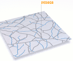 Places with similar names to Védaga, Burkina Faso ::
Disclaimer :: Information on this page comes without warranty of any kind |
||
|
Where is Védaga? Elevation and coordinates ::
Latitude (lat): 12°24'0"N Longitude (lon): 0°22'0"W
Elevation (approx.): 313m (map arrows pan, magnifying glasses zoom) |
||
|
Visiting Védaga? Hotel/Accommodation ::
Book a hotel in Védaga Travel Guide ::
rental cars ::
car rental offers GPS waypoint ::
download a GPX waypoint (PoI) of Védaga for your GPS receiver
|
||