|
search place name
|
||
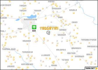
Yadgayiri (Kadiogo, Burkina Faso)Yadgayiri is a town in the Kadiogo region of Burkina Faso. An overview map of the region around Yadgayiri is displayed below.
regional and 3d topo map of Yadgayiri, Burkina Faso ::
Yadgayiri airports ::
The nearest airport is OUA - Ouagadougou, located 6.3 km north west of Yadgayiri.
Nearby towns ::
Dagmongo (2.1km east) //
Guensen (2.1km south) //
Koubri Nabmanaguéma (2.3km south west) //
Yamtenga (2.3km north east) //
Lalnoyiri (2.6km south west) //
Nogtaba (3.0km south west) //
Balkoui (3.2km south) //
Nabmanaguéma (3.6km south west) //
Zétégomdé (3.7km south east) //
Kouila (4.5km south east) //
Koanguen (4.7km west) //
Oiudtenga (4.9km south east) //
Taptenga (5.0km north) //
Kossiam (4.9km south west) //
Sogoden (5.0km east) //
Yargo (5.3km south west) //
Kossodo (5.3km south east) //
Samben (5.5km east) //
Banogo (5.6km south west) //
Koulogrouré (5.7km north east) //
Zone de la Patte dʼOie (5.9km west) //
Dassasgo (6.5km north) //
Samben (7.0km north east) //
Bilbalogo (7.0km north east) //
Sabtenga (7.0km north east) //
Tangséga (7.0km east) //
Tanlarkouri (7.1km east) //
Saba (7.2km north east) //
Godren (7.4km north) //
[all distances 'as the bird flies' and approximate] 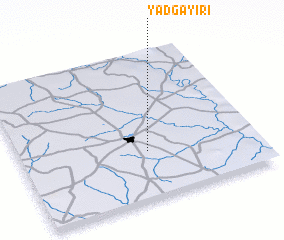 Places with similar names to Yadgayiri, Burkina Faso :: Disclaimer :: Information on this page comes without warranty of any kind |
||
|
Where is Yadgayiri? Elevation and coordinates ::
Latitude (lat): 12°19'34"N Longitude (lon): 1°27'43"W
Elevation (approx.): 311m (map arrows pan, magnifying glasses zoom) |
||
|
Visiting Yadgayiri? Hotel/Accommodation ::
Book a hotel in Yadgayiri Travel Guide ::
rental cars ::
car rental offers GPS waypoint ::
download a GPX waypoint (PoI) of Yadgayiri for your GPS receiver
|
||