|
search place name
|
||
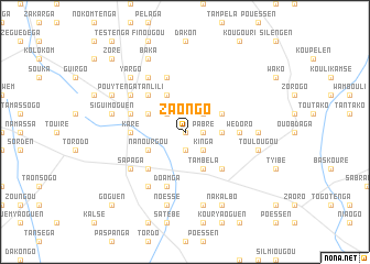
Zaongo (Burkina Faso)Zaongo is a town in Burkina Faso. An overview map of the region around Zaongo is displayed below.
regional and 3d topo map of Zaongo, Burkina Faso ::
Zaongo airports ::
The nearest airport is OUA - Ouagadougou, located 123.8 km west of Zaongo.
Nearby towns ::
Koulbalé (0.0km north) //
Pabré (1.8km east) //
Itènga (1.9km south) //
Yargo (2.6km north east) //
Goalga (2.6km north east) //
Kinga (2.6km south east) //
Pissalogo (2.6km north west) //
Kougui (3.6km east) //
Koudmi (4.1km north east) //
Léamtenga (4.1km north west) //
Tambéla (4.1km south east) //
Damèsèn (4.1km north west) //
Poéssé (4.1km north west) //
Nanourgou (4.1km south west) //
Koupéla (5.2km south east) //
Baka (5.2km north west) //
Goargo (5.2km south west) //
Karé (5.4km west) //
Wédoro (5.4km east) //
Baryou (5.7km west) //
Doamga (5.8km south) //
Kakobaratenga (5.8km north) //
Namassa (6.6km north west) //
Pouytenga Tanlili (6.6km north west) //
Balmen (6.6km south west) //
Kolastenga (6.6km south west) //
Sapaga (6.6km south west) //
Baka (6.6km north west) //
Tangen (6.6km north west) //
[all distances 'as the bird flies' and approximate] 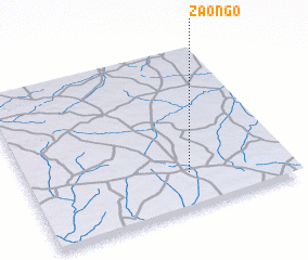 Places with similar names to Zaongo, Burkina Faso ::
Disclaimer :: Information on this page comes without warranty of any kind |
||
|
Where is Zaongo? Elevation and coordinates ::
Latitude (lat): 12°13'0"N Longitude (lon): 0°23'0"W
Elevation (approx.): 302m (map arrows pan, magnifying glasses zoom) |
||
|
Visiting Zaongo? Hotel/Accommodation ::
Book a hotel in Zaongo Travel Guide ::
rental cars ::
car rental offers GPS waypoint ::
download a GPX waypoint (PoI) of Zaongo for your GPS receiver
|
||