|
search place name
|
||
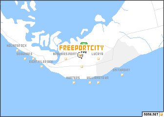
Freeport City (Freeport, Bahamas, The)Freeport City is a town in the Freeport region of Bahamas, The. An overview map of the region around Freeport City is displayed below.
regional and 3d topo map of Freeport City, Bahamas, The ::
Freeport City airports ::
The nearest airport is FPO - Freeport Grand Bahama Intl, located 2.8 km north of Freeport City.
Other airports nearby include BIM - Alice Town South Bimini (108.2 km south west), TCB - Treasure Cay (132.4 km east), PBI - West Palm Beach Palm Beach Intl (140.0 km west), CCZ - Chub Cay (148.4 km south east), Nearby towns ::
Russell Town (1.9km south) //
Braudies Point (3.3km west) //
Lucaya (3.3km east) //
Pinders Point (5.8km south) //
Hunters (5.8km south) //
Williams Town (6.5km south east) //
[all distances 'as the bird flies' and approximate] 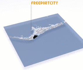 Places with similar names to Freeport City, Bahamas, The :: Disclaimer :: Information on this page comes without warranty of any kind |
||
|
Where is Freeport City? Elevation and coordinates ::
Latitude (lat): 26°32'0"N Longitude (lon): 78°42'0"W
Elevation (approx.): 6m (map arrows pan, magnifying glasses zoom) |
||
|
Visiting Freeport City? Hotel/Accommodation ::
Book a hotel in Freeport City Travel Guide ::
rental cars ::
car rental offers GPS waypoint ::
download a GPX waypoint (PoI) of Freeport City for your GPS receiver
|
||