|
search place name
|
||
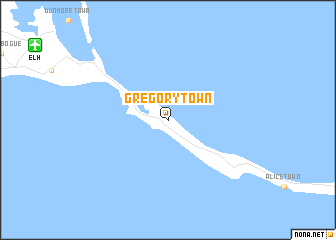
Gregory Town (Governorʼs Harbour, Bahamas, The)Gregory Town is a town in the Governorʼs Harbour region of Bahamas, The. An overview map of the region around Gregory Town is displayed below.
regional and 3d topo map of Gregory Town, Bahamas, The ::
Gregory Town airports ::
The nearest airport is ELH - North Eleuthera, located 15.8 km north west of Gregory Town.
Other airports nearby include GHB - Governor's Harbor Governors Harbour (25.5 km south east), RSD - Rock Sound (67.7 km south east), NAS - Nassau Lynden Pindling Intl (100.6 km south west), CCZ - Chub Cay (133.9 km west), Nearby towns ::
[all distances 'as the bird flies' and approximate] 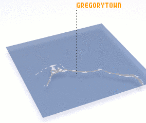 Places with similar names to Gregory Town, Bahamas, The ::
// Crockertown (US)
// Crackertown (US)
// Crockertown (US)
// Gregorytown (US)
// Karkartān (IR)
// Kärragården (SE)
// Kärrgården (SE)
// Kirk Ireton (GB)
Disclaimer :: Information on this page comes without warranty of any kind |
||
|
Where is Gregory Town? Elevation and coordinates ::
Latitude (lat): 25°24'0"N Longitude (lon): 76°33'0"W
Elevation (approx.): 33m (map arrows pan, magnifying glasses zoom) |
||
|
Visiting Gregory Town? Hotel/Accommodation ::
Book a hotel in Gregory Town Travel Guide ::
rental cars ::
car rental offers GPS waypoint ::
download a GPX waypoint (PoI) of Gregory Town for your GPS receiver
|
||