|
search place name
|
||
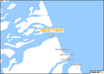
Moxey Town (Kemps Bay, Bahamas, The)Moxey Town is a town in the Kemps Bay region of Bahamas, The. An overview map of the region around Moxey Town is displayed below.
regional and 3d topo map of Moxey Town, Bahamas, The ::
Moxey Town airports ::
The nearest airport is ASD - Andros Town Fresh Creek, located 45.6 km north of Moxey Town.
Other airports nearby include NAS - Nassau Lynden Pindling Intl (84.8 km north), SAQ - San Andros (91.3 km north west), CCZ - Chub Cay (125.3 km north), ELH - North Eleuthera (164.7 km north east), Nearby towns ::
Mangrove Cay (6.5km south east) //
Bastian Point (9.0km south east) //
[all distances 'as the bird flies' and approximate] 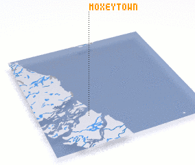 Places with similar names to Moxey Town, Bahamas, The ::
Disclaimer :: Information on this page comes without warranty of any kind |
||
|
Where is Moxey Town? Elevation and coordinates ::
Latitude (lat): 24°18'0"N Longitude (lon): 77°41'0"W
Elevation (approx.): -32768m (map arrows pan, magnifying glasses zoom) |
||
|
Visiting Moxey Town? Hotel/Accommodation ::
Book a hotel in Moxey Town Travel Guide ::
rental cars ::
car rental offers GPS waypoint ::
download a GPX waypoint (PoI) of Moxey Town for your GPS receiver
|
||