|
search place name
|
||
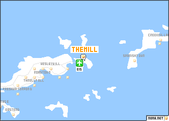
The Mill (British Virgin Islands)The Mill is a town in British Virgin Islands. An overview map of the region around The Mill is displayed below.
regional and 3d topo map of The Mill, British Virgin Islands ::
The Mill airports ::
The nearest airport is EIS - Roadtown/beef Island Terrance B Lettsome Intl, located 1.2 km south west of The Mill.
Other airports nearby include STT - St. Thomas Cyril E King (48.1 km west), STX - St. Criox Island Henry E Rohlsen (87.4 km south), FAJ - Fajardo Diego Jimenez Torres (120.3 km west), SJU - San Juan Luis Munoz Marin Intl (155.1 km west), Nearby towns ::
Long Swamp (4.0km south west) //
Maya Cove (5.1km south west) //
Kingstown (6.4km south west) //
Wesley Will (7.3km west) //
[all distances 'as the bird flies' and approximate] 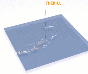 Places with similar names to The Mill, British Virgin Islands ::
Disclaimer :: Information on this page comes without warranty of any kind |
||
|
Where is The Mill? Elevation and coordinates ::
Latitude (lat): 18°27'0"N Longitude (lon): 64°32'0"W
Elevation (approx.): -32768m (map arrows pan, magnifying glasses zoom) |
||
|
Visiting The Mill? Hotel/Accommodation ::
Book a hotel in The Mill Travel Guide ::
rental cars ::
car rental offers GPS waypoint ::
download a GPX waypoint (PoI) of The Mill for your GPS receiver
|
||