|
search place name
|
||
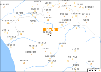
Binyuro (Bururi, Burundi)Binyuro is a town in the Bururi region of Burundi. An overview map of the region around Binyuro is displayed below.
regional and 3d topo map of Binyuro, Burundi ::
Binyuro airports ::
The nearest airport is BJM - Bujumbura Intl, located 87.6 km north west of Binyuro.
Other airports nearby include KME - Kamembe (193.2 km north west), FMI - Kalemie (205.6 km south), BKY - Bukavu/kavumu Bukavu Kavumu (213.2 km north west), Nearby towns ::
Bukanda (1.5km north west) //
Kaganza (4.6km south west) //
Muramba (5.6km south east) //
Vyanda (5.8km south) //
Nyamitare (6.0km north east) //
Gahama (6.0km north east) //
Muyuga (6.1km north) //
Mwandaro (6.4km south) //
Nyakarambo (7.7km north) //
Ndagano (7.8km north east) //
Gitega (7.9km north west) //
Mazinga (8.0km south west) //
Nyamagana (8.4km south) //
Tarire (8.8km north) //
Mahando (8.9km north east) //
Mizigo (9.1km north west) //
Kaberenge (10.0km south west) //
Kajabure (10.2km north west) //
Muzura (10.7km north east) //
Martyazo (11.9km south east) //
[all distances 'as the bird flies' and approximate]  Places with similar names to Binyuro, Burundi ::
// Ban Yai Rai (TH)
// Ban Yi Rae (TH)
// Bonyori (BF)
// Bonyori (BF)
// Bunyore (KE)
// Bonyeri (GH)
// Bunyiri (UG)
// Bunyiro (UG)
// Bin Yauri (NG)
// Binyeri (NG)
Disclaimer :: Information on this page comes without warranty of any kind |
||
|
Where is Binyuro? Elevation and coordinates ::
Latitude (lat): 4°3'15"S Longitude (lon): 29°37'27"E
Elevation (approx.): 2049m (map arrows pan, magnifying glasses zoom) |
||
|
Visiting Binyuro? Hotel/Accommodation ::
Book a hotel in Binyuro Travel Guide ::
Buy a travel guide for Burundi rental cars ::
car rental offers GPS waypoint ::
download a GPX waypoint (PoI) of Binyuro for your GPS receiver
|
||