|
search place name
|
||
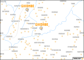
Gikombe (Karuzi, Burundi)Gikombe is a town in the Karuzi region of Burundi. An overview map of the region around Gikombe is displayed below.
regional and 3d topo map of Gikombe, Burundi ::
Gikombe airports ::
The nearest airport is BJM - Bujumbura Intl, located 90.5 km west of Gikombe.
Other airports nearby include KGL - Kigali Intl (149.7 km north), KME - Kamembe (166.1 km north west), BKY - Bukavu/kavumu Bukavu Kavumu (185.0 km north west), GYI - Gisenyi (206.3 km north west), Nearby towns ::
Ranga (3.1km west) //
Kinyoni (3.3km south west) //
Gafunzo (3.4km north east) //
Kimani (3.5km north) //
Gitibu (4.3km north east) //
Rwakagari (4.5km west) //
Bwumanyi (4.6km south) //
Buhigwe (4.7km south west) //
Kuwigitabu (5.0km west) //
Bukamba (5.1km south west) //
Muhera (5.7km north) //
Kigora (6.1km west) //
Bigugo (6.2km north east) //
Nyabikere (6.6km north) //
Kanyenumbu (6.8km south) //
Carire (7.4km north west) //
Muhororo (7.6km west) //
Mikingu (7.9km south east) //
Zanandore (7.9km north) //
Gasigati (8.2km south west) //
Gitema (8.2km south) //
Rutoke (8.3km north) //
Buhu (8.6km south west) //
Butezi (8.7km south) //
Mikore (8.8km north) //
Rwinkona (8.9km south west) //
Nkanda (9.0km north east) //
Gitega (9.1km south west) //
Mugogo (9.2km south west) //
[all distances 'as the bird flies' and approximate]  Places with similar names to Gikombe, Burundi ::
Disclaimer :: Information on this page comes without warranty of any kind |
||
|
Where is Gikombe? Elevation and coordinates ::
Latitude (lat): 3°19'20"S Longitude (lon): 30°7'59"E
Elevation (approx.): 1518m (map arrows pan, magnifying glasses zoom) |
||
|
Visiting Gikombe? Hotel/Accommodation ::
Book a hotel in Gikombe Travel Guide ::
Buy a travel guide for Burundi rental cars ::
car rental offers GPS waypoint ::
download a GPX waypoint (PoI) of Gikombe for your GPS receiver
|
||