|
search place name
|
||
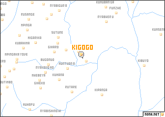
Kigogo (Rutana, Burundi)Kigogo is a town in the Rutana region of Burundi. An overview map of the region around Kigogo is displayed below.
regional and 3d topo map of Kigogo, Burundi ::
Kigogo airports ::
The nearest airport is BJM - Bujumbura Intl, located 119.9 km north west of Kigogo.
Other airports nearby include KGL - Kigali Intl (202.7 km north), KME - Kamembe (213.0 km north west), BKY - Bukavu/kavumu Bukavu Kavumu (232.7 km north west), Nearby towns ::
Murwanzu (1.0km south east) //
Rutare (1.9km north west) //
Muntwana (4.1km south west) //
Nkurye (4.2km north west) //
Giharo (6.6km west) //
Gasaka (6.7km north west) //
Kumana (7.2km south west) //
Suture (7.4km north west) //
Bugondo (7.9km west) //
Rutare (8.0km south) //
Nyakavomo (9.0km west) //
Kipanga (9.4km south east) //
Nyabweru (10.0km north east) //
[all distances 'as the bird flies' and approximate] 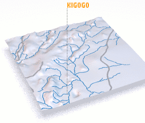 Places with similar names to Kigogo, Burundi ::
Disclaimer :: Information on this page comes without warranty of any kind |
||
|
Where is Kigogo? Elevation and coordinates ::
Latitude (lat): 3°47'43"S Longitude (lon): 30°17'27"E
Elevation (approx.): 1204m (map arrows pan, magnifying glasses zoom) |
||
|
Visiting Kigogo? Hotel/Accommodation ::
Book a hotel in Kigogo Travel Guide ::
Buy a travel guide for Burundi rental cars ::
car rental offers GPS waypoint ::
download a GPX waypoint (PoI) of Kigogo for your GPS receiver
|
||