|
search place name
|
||
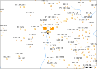
Manga (Bururi, Burundi)Manga is a town in the Bururi region of Burundi. An overview map of the region around Manga is displayed below.
regional and 3d topo map of Manga, Burundi ::
Manga airports ::
The nearest airport is BJM - Bujumbura Intl, located 49.1 km north west of Manga.
Other airports nearby include KME - Kamembe (154.8 km north west), BKY - Bukavu/kavumu Bukavu Kavumu (174.9 km north west), KGL - Kigali Intl (204.5 km north), Nearby towns ::
Gicungwe (1.1km north east) //
Kararo (1.1km south) //
Ngoma (1.9km west) //
Gwiyagiro (2.9km north) //
Mugongo (4.0km south) //
Muzimu (4.1km south east) //
Tora (4.4km north east) //
Nyakibuye (4.6km north west) //
Ruhinga (5.1km north west) //
Kwishwi (5.2km south east) //
Rusarenda (5.4km east) //
Kizuga (5.4km south) //
Rusakiro (5.7km north west) //
Nyanza (5.7km north east) //
Nyagishiha (5.9km north) //
Mahwane (6.2km north) //
Kiganza (6.3km west) //
Bura (6.7km south) //
Nyagitwenzi (6.7km north east) //
Gahagaze (7.2km north east) //
Kinyoni (7.4km east) //
Donzi (7.4km west) //
Gasema (7.4km south east) //
Ringira (7.7km north east) //
Mugamba (8.0km north east) //
Muramba (8.5km north east) //
Numbwe (8.6km south west) //
Ntentamaza (9.4km north east) //
Cunda (9.6km south east) //
[all distances 'as the bird flies' and approximate] 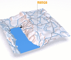 Places with similar names to Manga, Burundi ::
Disclaimer :: Information on this page comes without warranty of any kind |
||
|
Where is Manga? Elevation and coordinates ::
Latitude (lat): 3°42'49"S Longitude (lon): 29°31'53"E
Elevation (approx.): 1963m (map arrows pan, magnifying glasses zoom) |
||
|
Visiting Manga? Hotel/Accommodation ::
Book a hotel in Manga Travel Guide ::
Buy a travel guide for Burundi rental cars ::
car rental offers GPS waypoint ::
download a GPX waypoint (PoI) of Manga for your GPS receiver
|
||