|
search place name
|
||
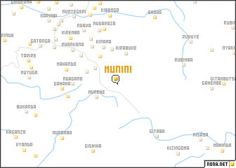
Munini (Bururi, Burundi)Munini is a town in the Bururi region of Burundi. An overview map of the region around Munini is displayed below.
regional and 3d topo map of Munini, Burundi ::
Munini airports ::
The nearest airport is BJM - Bujumbura Intl, located 89.1 km north west of Munini.
Other airports nearby include KME - Kamembe (194.5 km north west), FMI - Kalemie (213.5 km south), BKY - Bukavu/kavumu Bukavu Kavumu (214.7 km north west), Nearby towns ::
Rushiha (2.1km north) //
Murehe (4.0km south west) //
Kabogora (4.3km north west) //
Kirabuke (5.0km north) //
Kivuruga (5.2km north west) //
Muzura (5.2km west) //
Musorora (5.5km north) //
Kinama (6.2km north) //
Ndagano (7.1km west) //
Buta (7.1km north west) //
Rudegwe (7.3km north west) //
Nyamitare (8.1km west) //
Kagomogomo (8.3km north west) //
Mahando (8.4km west) //
Gahama (8.8km west) //
Kamvumvu (8.9km north) //
Rwankona (8.9km north west) //
Mudaraza (9.0km north) //
Ndava (10.0km north west) //
Kiremba (10.4km north west) //
Gitaba (10.5km south east) //
Muramba (12.3km south west) //
[all distances 'as the bird flies' and approximate] 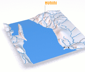 Places with similar names to Munini, Burundi ::
Disclaimer :: Information on this page comes without warranty of any kind |
||
|
Where is Munini? Elevation and coordinates ::
Latitude (lat): 4°0'31"S Longitude (lon): 29°44'31"E
Elevation (approx.): 1963m (map arrows pan, magnifying glasses zoom) |
||
|
Visiting Munini? Hotel/Accommodation ::
Book a hotel in Munini Travel Guide ::
Buy a travel guide for Burundi rental cars ::
car rental offers GPS waypoint ::
download a GPX waypoint (PoI) of Munini for your GPS receiver
|
||