|
search place name
|
||
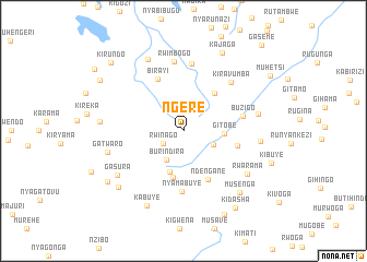
Ngere (Kirundo, Burundi)Ngere is a town in the Kirundo region of Burundi. An overview map of the region around Ngere is displayed below.
regional and 3d topo map of Ngere, Burundi ::
Ngere airports ::
The nearest airport is KGL - Kigali Intl, located 75.1 km north of Ngere.
Other airports nearby include BJM - Bujumbura Intl (120.1 km south west), KME - Kamembe (141.1 km west), GYI - Gisenyi (147.1 km north west), GOM - Goma (149.2 km north west), Nearby towns ::
Gatare (2.3km north) //
Rwinago (2.5km south west) //
Burindira (3.4km south west) //
Rugomero (3.4km south east) //
Gitobe (4.2km east) //
Nkomero (4.4km south) //
Runyinya (4.9km south) //
Rwimbogo (5.0km north east) //
Ndengane (5.5km south east) //
Marembo (5.7km east) //
Birayi (5.9km north west) //
Nyamabuye (6.2km south) //
Buzigo (6.2km east) //
Kiravumba (6.9km north east) //
Karehe (7.0km north) //
Rwimbogo (7.2km north) //
Gisoko (7.8km east) //
Rwarama (7.9km south east) //
Nyaruteza (7.9km east) //
Gasura (8.1km south west) //
Gatwaro (8.1km west) //
Kibande (8.1km north west) //
Kabuye (8.5km south west) //
Musenga (8.5km south east) //
Kibande (8.6km west) //
Vumbi (8.7km south west) //
Kajaga (8.9km north east) //
Gisezerwa (9.4km south west) //
Kidasha (9.5km south east) //
[all distances 'as the bird flies' and approximate] 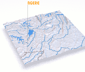 Places with similar names to Ngere, Burundi ::
Disclaimer :: Information on this page comes without warranty of any kind |
||
|
Where is Ngere? Elevation and coordinates ::
Latitude (lat): 2°38'50"S Longitude (lon): 30°9'49"E
Elevation (approx.): 1748m (map arrows pan, magnifying glasses zoom) |
||
|
Visiting Ngere? Hotel/Accommodation ::
Book a hotel in Ngere Travel Guide ::
Buy a travel guide for Burundi rental cars ::
car rental offers GPS waypoint ::
download a GPX waypoint (PoI) of Ngere for your GPS receiver
|
||