|
search place name
|
||
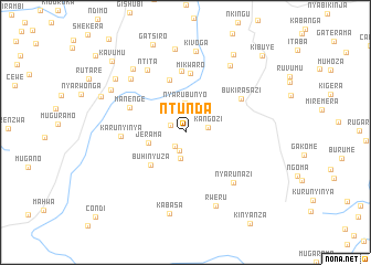
Ntunda (Gitega, Burundi)Ntunda is a town in the Gitega region of Burundi. An overview map of the region around Ntunda is displayed below.
regional and 3d topo map of Ntunda, Burundi ::
Ntunda airports ::
The nearest airport is BJM - Bujumbura Intl, located 80.1 km north west of Ntunda.
Other airports nearby include KME - Kamembe (179.6 km north west), KGL - Kigali Intl (197.0 km north), BKY - Bukavu/kavumu Bukavu Kavumu (199.8 km north west), Nearby towns ::
Mponyi (1.7km north west) //
Ndava (1.7km south west) //
Buraza (1.9km south) //
Kangozi (2.4km east) //
Gitabo (2.7km south) //
Nyarubunyo (3.0km north) //
Jerama (3.8km west) //
Buhinyuza (4.8km south west) //
Burunga (5.5km north) //
Mikwaro (6.0km north) //
Manenge (6.1km north west) //
Bihahe (6.2km north) //
Karunyinya (6.5km west) //
Bukirasazi (6.5km north east) //
Nyarunazi (7.0km south east) //
Ntita (7.4km north west) //
Karambi (7.7km north west) //
Rweru (8.0km south) //
Gatongati (8.1km north east) //
Kivoga (8.3km north) //
Kwinzero (8.3km north west) //
Kabasa (8.3km south) //
Nyabitanga (8.5km north) //
Nkondo (8.6km north west) //
Buterama (8.9km north west) //
Muvumero (9.2km north east) //
Muyuga (9.3km north west) //
Kavumu (10.3km north west) //
Kibuye (11.0km north east) //
[all distances 'as the bird flies' and approximate] 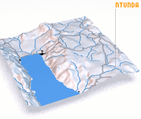 Places with similar names to Ntunda, Burundi ::
Disclaimer :: Information on this page comes without warranty of any kind |
||
|
Where is Ntunda? Elevation and coordinates ::
Latitude (lat): 3°44'6"S Longitude (lon): 29°54'43"E
Elevation (approx.): 1708m (map arrows pan, magnifying glasses zoom) |
||
|
Visiting Ntunda? Hotel/Accommodation ::
Book a hotel in Ntunda Travel Guide ::
Buy a travel guide for Burundi rental cars ::
car rental offers GPS waypoint ::
download a GPX waypoint (PoI) of Ntunda for your GPS receiver
|
||