|
search place name
|
||
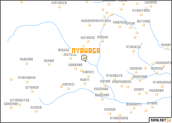
Nyawaga (Rutana, Burundi)Nyawaga is a town in the Rutana region of Burundi. An overview map of the region around Nyawaga is displayed below.
regional and 3d topo map of Nyawaga, Burundi ::
Nyawaga airports ::
The nearest airport is BJM - Bujumbura Intl, located 102.7 km north west of Nyawaga.
Other airports nearby include KME - Kamembe (203.8 km north west), KGL - Kigali Intl (216.7 km north), BKY - Bukavu/kavumu Bukavu Kavumu (223.9 km north west), FMI - Kalemie (232.2 km south), Nearby towns ::
Kayige (2.3km south west) //
Dabambe (2.7km south west) //
Shoti (3.3km north) //
Kibinzi (3.3km south) //
Rutana (3.4km west) //
Muyange (4.4km north) //
Mwayi (4.8km south) //
Bigugo (5.1km west) //
Ningwe (5.8km north east) //
Kiziba (6.7km south east) //
Karinzi (7.0km south west) //
Nyembuye (7.4km south east) //
Butambara (7.6km south west) //
Rugombo (7.7km south east) //
Mugarama (8.0km north) //
Nemba (8.0km west) //
Kinyovu (9.0km north east) //
Bukemba (9.0km south east) //
Kibonobono (9.4km south east) //
Kabingo (10.6km north east) //
[all distances 'as the bird flies' and approximate] 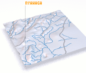
Disclaimer :: Information on this page comes without warranty of any kind |
||
|
Where is Nyawaga? Elevation and coordinates ::
Latitude (lat): 3°55'29"S Longitude (lon): 30°1'24"E
Elevation (approx.): 1468m (map arrows pan, magnifying glasses zoom) |
||
|
Visiting Nyawaga? Hotel/Accommodation ::
Book a hotel in Nyawaga Travel Guide ::
Buy a travel guide for Burundi rental cars ::
car rental offers GPS waypoint ::
download a GPX waypoint (PoI) of Nyawaga for your GPS receiver
|
||