|
search place name
|
||
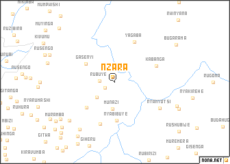
Nzara (Muyinga, Burundi)Nzara is a town in the Muyinga region of Burundi. An overview map of the region around Nzara is displayed below.
regional and 3d topo map of Nzara, Burundi ::
Nzara airports ::
The nearest airport is KGL - Kigali Intl, located 110.9 km north of Nzara.
Other airports nearby include BJM - Bujumbura Intl (132.0 km west), KME - Kamembe (177.7 km west), GYI - Gisenyi (190.4 km north west), GOM - Goma (192.5 km north west), Nearby towns ::
Nyabisinda (1.9km south west) //
Rubuye (2.5km west) //
Kiyange (3.8km south west) //
Munazi (4.4km south) //
Gasenyi (5.6km north west) //
Kivoga (6.2km south west) //
Nyabibuye (6.3km south) //
Kabanga (7.2km east) //
Mutenza (7.2km south) //
Yagaba (7.3km north east) //
Nyamyotsi (8.5km south east) //
Mumbizi (9.7km south west) //
Bukinja (9.7km south west) //
Gitwa (10.7km south west) //
Nyanza (10.8km south west) //
Karambi (11.4km south west) //
Kayogoro (12.0km south west) //
[all distances 'as the bird flies' and approximate] 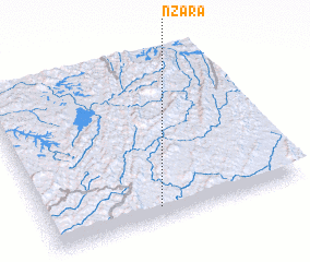 Places with similar names to Nzara, Burundi ::
Disclaimer :: Information on this page comes without warranty of any kind |
||
|
Where is Nzara? Elevation and coordinates ::
Latitude (lat): 2°55'32"S Longitude (lon): 30°26'17"E
Elevation (approx.): 1441m (map arrows pan, magnifying glasses zoom) |
||
|
Visiting Nzara? Hotel/Accommodation ::
Book a hotel in Nzara Travel Guide ::
Buy a travel guide for Burundi rental cars ::
car rental offers GPS waypoint ::
download a GPX waypoint (PoI) of Nzara for your GPS receiver
|
||