|
search place name
|
||
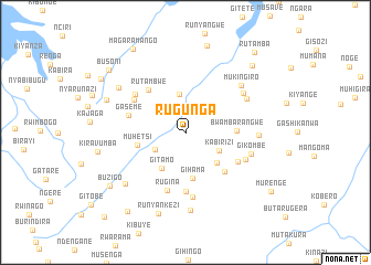
Rugunga (Kirundo, Burundi)Rugunga is a town in the Kirundo region of Burundi. An overview map of the region around Rugunga is displayed below.
regional and 3d topo map of Rugunga, Burundi ::
Rugunga airports ::
The nearest airport is KGL - Kigali Intl, located 70.0 km north of Rugunga.
Other airports nearby include BJM - Bujumbura Intl (135.2 km south west), GYI - Gisenyi (152.1 km north west), KME - Kamembe (154.0 km west), GOM - Goma (154.3 km north west), Nearby towns ::
Mbizi (3.5km south west) //
Kabirizi (3.8km south east) //
Mahamba (3.9km north) //
Gitamo (4.3km south west) //
Gasenyi (4.5km south east) //
Gihama (4.7km south) //
Muhetsi (5.0km west) //
Bwambarangwe (5.2km east) //
Ntita (5.7km south east) //
Rutambwe (5.7km north west) //
Gisenga (5.9km south) //
Gaseme (6.0km west) //
Ruhorongo (6.0km south east) //
Rugina (6.1km south) //
Mubira (6.1km north west) //
Murore (6.3km north west) //
Rukobero (6.6km south) //
Ntamba (6.7km south east) //
Gikombe (7.0km east) //
Kiryama (7.0km north east) //
Ngara (7.1km north east) //
Mukingiro (7.4km north east) //
Gishehe (7.5km east) //
Bugorora (7.9km south) //
Gisoko (8.0km south west) //
Muhetsi (8.1km north west) //
Kigomero (8.7km north west) //
Runyankezi (8.7km south) //
Muvyuko (9.0km north) //
[all distances 'as the bird flies' and approximate] 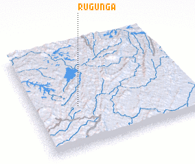 Places with similar names to Rugunga, Burundi ::
Disclaimer :: Information on this page comes without warranty of any kind |
||
|
Where is Rugunga? Elevation and coordinates ::
Latitude (lat): 2°35'4"S Longitude (lon): 30°17'13"E
Elevation (approx.): 1510m (map arrows pan, magnifying glasses zoom) |
||
|
Visiting Rugunga? Hotel/Accommodation ::
Book a hotel in Rugunga Travel Guide ::
Buy a travel guide for Burundi rental cars ::
car rental offers GPS waypoint ::
download a GPX waypoint (PoI) of Rugunga for your GPS receiver
|
||