|
search place name
|
||
Kingui (Central African Republic)Kingui is a town in Central African Republic. An overview map of the region around Kingui is displayed below.
regional and 3d topo map of Kingui, Central African Republic ::
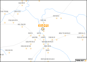
Nearby towns ::
Yanda (0.0km north) //
Dembé (1.9km south) //
Godo (1.9km north) //
Bligaba (1.9km north) //
Bingui (1.9km north) //
Dris (2.6km south west) //
Kaba (3.7km south) //
Gazao (3.7km north) //
Dagba (5.2km south west) //
Yabaka (5.2km south east) //
Kaga Bandoro (5.6km south) //
Popo (5.8km west) //
Sambawanga (5.9km south) //
Boubou (6.6km south east) //
Bokengé (7.4km south) //
Bokada (7.6km south) //
Mbroua (7.6km south) //
Goupandé (7.8km south west) //
Bobazi (7.8km south west) //
Mindou (7.8km north east) //
Boto (9.2km south west) //
Kotagombé (9.2km north east) //
Koudouésé (10.4km south west) //
Boto (10.4km south west) //
[all distances 'as the bird flies' and approximate] 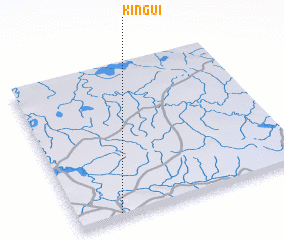 Places with similar names to Kingui, Central African Republic ::
Disclaimer :: Information on this page comes without warranty of any kind |
||
|
Where is Kingui? Elevation and coordinates ::
Latitude (lat): 7°2'0"N Longitude (lon): 19°11'0"E
Elevation (approx.): 422m (map arrows pan, magnifying glasses zoom) |
||
|
Visiting Kingui? Hotel/Accommodation ::
Book a hotel in Kingui Travel Guide ::
rental cars ::
car rental offers GPS waypoint ::
download a GPX waypoint (PoI) of Kingui for your GPS receiver
|
||