|
search place name
|
||
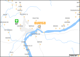
Ouango (Central African Republic)Ouango is a town in Central African Republic. An overview map of the region around Ouango is displayed below.
regional and 3d topo map of Ouango, Central African Republic ::
Ouango airports ::
The nearest airport is BGF - Bangui M Poko, located 11.4 km west of Ouango.
Other airports nearby include GMA - Gemena (179.2 km south east), Nearby towns ::
Camp du Kassaï (1.9km north) //
Badokwa (2.6km south east) //
Zongo (2.6km south west) //
Baraka (2.6km south west) //
Bangui (3.7km west) //
Nguitou (4.1km north west) //
Saratumba (4.1km south west) //
Dédengué (6.7km north west) //
Bogo II (7.4km east) //
Banga (7.4km south) //
Gobongo (9.2km north west) //
Potopoto (9.2km north west) //
Bimbo (10.5km south west) //
[all distances 'as the bird flies' and approximate] 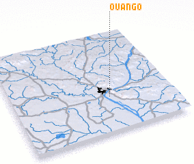 Places with similar names to Ouango, Central African Republic ::
Disclaimer :: Information on this page comes without warranty of any kind |
||
|
Where is Ouango? Elevation and coordinates ::
Latitude (lat): 4°22'0"N Longitude (lon): 18°37'0"E
Elevation (approx.): 365m (map arrows pan, magnifying glasses zoom) |
||
|
Visiting Ouango? Hotel/Accommodation ::
Book a hotel in Ouango Travel Guide ::
rental cars ::
car rental offers GPS waypoint ::
download a GPX waypoint (PoI) of Ouango for your GPS receiver
|
||