|
search place name
|
||
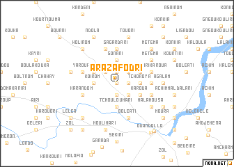
Arazafodri (Chari-Baguirmi, Chad)Arazafodri is a town in the Chari-Baguirmi region of Chad. An overview map of the region around Arazafodri is displayed below.
regional and 3d topo map of Arazafodri, Chad ::
Arazafodri airports ::
The nearest airport is NDJ - N'djamena Ndjamena Hassan Djamous, located 125.0 km south west of Arazafodri.
Nearby towns ::
Mageti (0.0km north) //
Kélékélé Kouka (1.9km north) //
Brayarom (1.9km south) //
Djoumarti (1.8km east) //
Koukoua (2.6km north west) //
Kankouri (2.6km north east) //
Karasoua (2.6km south east) //
Sonari (3.7km north) //
Koirom (3.6km west) //
Tchoroya (3.6km east) //
Tchouloumari (3.7km south) //
Araza (4.1km north west) //
Arayourou (4.1km north east) //
Karoua (4.1km south east) //
Sagardari (5.6km north) //
Ngéléya (5.4km east) //
Yaroua (5.7km west) //
Dilindri (5.8km north) //
Yawari Karoua (5.7km east) //
Karandom (5.7km west) //
Boléati (5.8km south) //
Boula Bousou (5.7km east) //
Météma (6.6km north east) //
Kélékélé (6.6km north east) //
Malamousa (6.6km south east) //
Agalam (7.2km east) //
Karoua (7.2km east) //
Bélakiri (7.5km west) //
Koloula (7.5km west) //
[all distances 'as the bird flies' and approximate] 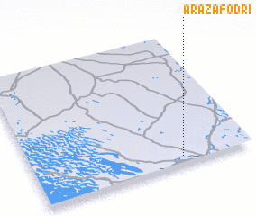 Places with similar names to Arazafodri, Chad :: Disclaimer :: Information on this page comes without warranty of any kind |
||
|
Where is Arazafodri? Elevation and coordinates ::
Latitude (lat): 13°4'0"N Longitude (lon): 15°41'0"E
Elevation (approx.): 292m (map arrows pan, magnifying glasses zoom) |
||
|
Visiting Arazafodri? Hotel/Accommodation ::
Book a hotel in Arazafodri Travel Guide ::
Buy a travel guide for Chad rental cars ::
car rental offers GPS waypoint ::
download a GPX waypoint (PoI) of Arazafodri for your GPS receiver
|
||