|
search place name
|
||
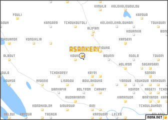
Asankéri (Chari-Baguirmi, Chad)Asankéri is a town in the Chari-Baguirmi region of Chad. An overview map of the region around Asankéri is displayed below.
regional and 3d topo map of Asankéri, Chad ::
Asankéri airports ::
The nearest airport is NDJ - N'djamena Ndjamena Hassan Djamous, located 124.0 km south west of Asankéri.
Nearby towns ::
Kouka (1.8km west) //
Kourtiouma (4.1km north east) //
Kayri (4.1km south east) //
Kadamalia (5.2km south east) //
Bourni (5.4km east) //
Diarkouloula (5.8km north) //
Boula Kouka (5.8km south) //
Alifari (6.5km north) //
Lisadou (6.6km south west) //
Tchokorey (6.6km south west) //
Boltrom (7.4km south) //
Tchoukoutoli (7.6km north) //
Kangara Touomousari (7.6km north) //
Chaway (8.2km south east) //
Kindjiri Malarom (8.1km north west) //
Darkafia (9.2km south west) //
Bélakiri (9.1km south east) //
Koloula (9.1km south east) //
Kélékélé Maloumari (10.3km north east) //
Kangara (10.3km north west) //
[all distances 'as the bird flies' and approximate]  Places with similar names to Asankéri, Chad ::
Disclaimer :: Information on this page comes without warranty of any kind |
||
|
Where is Asankéri? Elevation and coordinates ::
Latitude (lat): 13°8'0"N Longitude (lon): 15°33'0"E
Elevation (approx.): 288m (map arrows pan, magnifying glasses zoom) |
||
|
Visiting Asankéri? Hotel/Accommodation ::
Book a hotel in Asankéri Travel Guide ::
Buy a travel guide for Chad rental cars ::
car rental offers GPS waypoint ::
download a GPX waypoint (PoI) of Asankéri for your GPS receiver
|
||