|
search place name
|
||
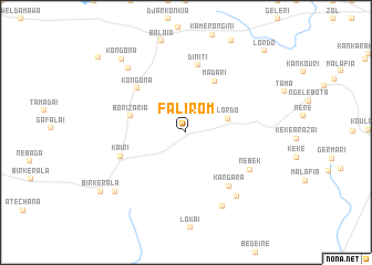
Falirom (Chari-Baguirmi, Chad)Falirom is a town in the Chari-Baguirmi region of Chad. An overview map of the region around Falirom is displayed below.
regional and 3d topo map of Falirom, Chad ::
Falirom airports ::
The nearest airport is NDJ - N'djamena Ndjamena Hassan Djamous, located 97.5 km south west of Falirom.
Nearby towns ::
Lordo (4.3km east) //
Borizaria (5.7km west) //
Madari (5.9km north east) //
Kongona (6.6km north west) //
Diniti (6.9km north) //
Kangara (6.9km south east) //
Kaïri (6.9km west) //
Nebek (7.4km south east) //
Am Chechiat (8.2km south east) //
Dibekre (8.3km south east) //
Aoudalou (8.6km north west) //
Arare (9.2km south west) //
Kongona (9.8km north west) //
Bir Kerala (10.3km south west) //
Lordo (11.2km north east) //
Dalladouri (11.5km north west) //
[all distances 'as the bird flies' and approximate] 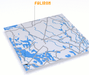 Places with similar names to Falirom, Chad ::
// Fulerum (DE)
// Villarmea (ES)
// Villarmeao (ES)
// Villermao (ES)
// Phal Rām (PK)
// Vila Aramá (BR)
// Falerum (SE)
// Vallarum (SE)
// Vuollerim (SE)
// Villarmoy (FR)
Disclaimer :: Information on this page comes without warranty of any kind |
||
|
Where is Falirom? Elevation and coordinates ::
Latitude (lat): 12°53'49"N Longitude (lon): 15°28'59"E
Elevation (approx.): 285m (map arrows pan, magnifying glasses zoom) |
||
|
Visiting Falirom? Hotel/Accommodation ::
Book a hotel in Falirom Travel Guide ::
Buy a travel guide for Chad rental cars ::
car rental offers GPS waypoint ::
download a GPX waypoint (PoI) of Falirom for your GPS receiver
|
||