|
search place name
|
||
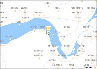
Iri (Mayo-Kébbi, Chad)Iri is a town in the Mayo-Kébbi region of Chad. An overview map of the region around Iri is displayed below.
regional and 3d topo map of Iri, Chad ::
Iri airports ::
The nearest airport is MVR - Maroua Salak, located 106.8 km north west of Iri.
Other airports nearby include MQQ - Moundou (178.6 km south east), GOU - Garoua (191.8 km west), MIU - Maiduguri (306.5 km north west), Nearby towns ::
Mangra (1.8km east) //
Mokaye (2.6km north west) //
Dolé (3.7km east) //
Tonton (5.8km west) //
Fieng (5.8km east) //
Matabeye (5.9km south) //
Daoua (7.6km north) //
Loudé (7.5km east) //
Tikem (7.6km south) //
Mindaoré (8.3km north west) //
Ourlargo (8.3km south west) //
Gé (9.2km north west) //
Boulembali (9.2km north west) //
Darbé (9.2km north west) //
Gabra (9.2km south east) //
[all distances 'as the bird flies' and approximate] 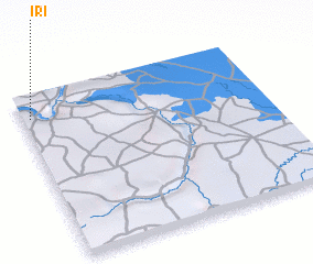 Places with similar names to Iri, Chad ::
Disclaimer :: Information on this page comes without warranty of any kind |
||
|
Where is Iri? Elevation and coordinates ::
Latitude (lat): 9°52'0"N Longitude (lon): 15°2'0"E
Elevation (approx.): 328m (map arrows pan, magnifying glasses zoom) |
||
|
Visiting Iri? Hotel/Accommodation ::
Book a hotel in Iri Travel Guide ::
Buy a travel guide for Chad rental cars ::
car rental offers GPS waypoint ::
download a GPX waypoint (PoI) of Iri for your GPS receiver
|
||