|
search place name
|
||
Tari (Kanem, Chad)Tari is a town in the Kanem region of Chad. An overview map of the region around Tari is displayed below.
regional and 3d topo map of Tari, Chad ::
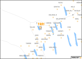
Nearby towns ::
Alotogrom (1.9km north) //
Touvou (2.6km south east) //
Téléri (3.6km west) //
Bem Bem (4.0km north east) //
Karka (4.0km north east) //
Démi (4.1km south west) //
Koutou (4.1km south east) //
Troufa (4.0km south east) //
Mapal (5.2km south east) //
Andra (5.6km south) //
Geltra (5.4km east) //
Démi (5.8km south) //
Arkinde (5.8km south) //
Mapal (5.7km east) //
Bara (7.6km south) //
Goni Goni (7.4km east) //
Kola Kola (7.7km north east) //
Tiarom (9.2km south west) //
[all distances 'as the bird flies' and approximate] 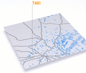 Places with similar names to Tari, Chad ::
Disclaimer :: Information on this page comes without warranty of any kind |
||
|
Where is Tari? Elevation and coordinates ::
Latitude (lat): 14°22'0"N Longitude (lon): 15°14'0"E
Elevation (approx.): 334m (map arrows pan, magnifying glasses zoom) |
||
|
Visiting Tari? Hotel/Accommodation ::
Book a hotel in Tari Travel Guide ::
Buy a travel guide for Chad rental cars ::
car rental offers GPS waypoint ::
download a GPX waypoint (PoI) of Tari for your GPS receiver
|
||