|
search place name
|
||
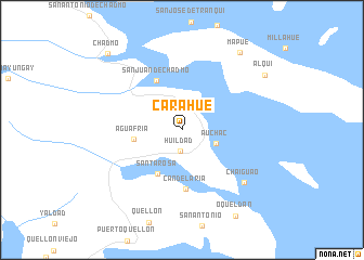
Carahue (Los Lagos, Chile)Carahue is a town in the Los Lagos region of Chile. An overview map of the region around Carahue is displayed below.
regional and 3d topo map of Carahue, Chile ::
Carahue airports ::
The nearest airport is WCH - Chaiten, located 71.2 km east of Carahue.
Other airports nearby include PMC - Puerto Montt El Tepual Intl (179.2 km north), Nearby towns ::
Huildad (2.2km south) //
Auchac (2.9km south east) //
Agua Fría (3.8km west) //
Santa Rosa (4.8km south) //
San Juan de Chadmo (5.4km north) //
Candelaria (6.1km south) //
Chaiguao (7.2km south east) //
Mapué (9.1km north east) //
Alqui (8.4km north east) //
Oqueldán (9.8km south east) //
Chadmo (9.6km north west) //
[all distances 'as the bird flies' and approximate] 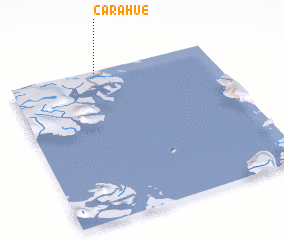 Places with similar names to Carahue, Chile ::
Disclaimer :: Information on this page comes without warranty of any kind |
||
|
Where is Carahue? Elevation and coordinates ::
Latitude (lat): 43°0'48"S Longitude (lon): 73°33'56"W
Elevation (approx.): 67m (map arrows pan, magnifying glasses zoom) |
||
|
Visiting Carahue? Hotel/Accommodation ::
Book a hotel in Carahue Travel Guide ::
Buy a travel guide for Chile rental cars ::
car rental offers GPS waypoint ::
download a GPX waypoint (PoI) of Carahue for your GPS receiver
|
||