|
search place name
|
||
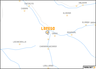
Laredo (Coquimbo, Chile)Laredo is a town in the Coquimbo region of Chile. An overview map of the region around Laredo is displayed below.
regional and 3d topo map of Laredo, Chile ::
Laredo airports ::
The nearest airport is LSC - La Serena La Florida, located 111.0 km north of Laredo.
Other airports nearby include MDZ - Mendoza El Plumerillo (289.4 km south east), Nearby towns ::
Chaguaral (1.9km south) //
Palermo (1.9km north) //
Carén (2.3km east) //
Chañaral de Carén (5.6km south) //
El Peñón (9.8km north east) //
[all distances 'as the bird flies' and approximate]  Places with similar names to Laredo, Chile ::
Disclaimer :: Information on this page comes without warranty of any kind |
||
|
Where is Laredo? Elevation and coordinates ::
Latitude (lat): 30°51'0"S Longitude (lon): 70°47'0"W
Elevation (approx.): 1090m (map arrows pan, magnifying glasses zoom) |
||
|
Visiting Laredo? Hotel/Accommodation ::
Book a hotel in Laredo Travel Guide ::
Buy a travel guide for Chile rental cars ::
car rental offers GPS waypoint ::
download a GPX waypoint (PoI) of Laredo for your GPS receiver
|
||