|
search place name
|
||
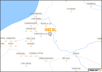
Macal (Maule, Chile)Macal is a town in the Maule region of Chile. An overview map of the region around Macal is displayed below.
regional and 3d topo map of Macal, Chile ::
Macal airports ::
The nearest airport is CCP - Concepcion Carriel Sur Intl, located 194.6 km south west of Macal.
Other airports nearby include SCL - Santiago Arturo Merino Benitez Intl (235.0 km north east), Nearby towns ::
Loma Blanca (2.4km south east) //
Carrizalillo (3.0km west) //
Peralillo (4.0km north) //
La Silleta (4.9km west) //
La Viñilla (4.9km west) //
Guilleumo (6.3km west) //
Pangales (6.3km west) //
Polcura (6.3km west) //
Los Espinos (6.3km west) //
Las Lomas (7.2km north west) //
Chanquiuque (7.1km north west) //
Peumos (7.1km south west) //
Los Rábanos (8.7km north west) //
Los Quillayes (8.7km south west) //
Canelillos (9.6km south west) //
[all distances 'as the bird flies' and approximate]  Places with similar names to Macal, Chile ::
Disclaimer :: Information on this page comes without warranty of any kind |
||
|
Where is Macal? Elevation and coordinates ::
Latitude (lat): 35°11'0"S Longitude (lon): 72°9'0"W
Elevation (approx.): 130m (map arrows pan, magnifying glasses zoom) |
||
|
Visiting Macal? Hotel/Accommodation ::
Book a hotel in Macal Travel Guide ::
Buy a travel guide for Chile rental cars ::
car rental offers GPS waypoint ::
download a GPX waypoint (PoI) of Macal for your GPS receiver
|
||