|
search place name
|
||
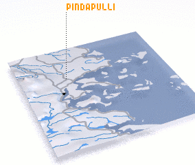
Pindapulli (Los Lagos, Chile)Pindapulli is a town in the Los Lagos region of Chile. An overview map of the region around Pindapulli is displayed below.
regional and 3d topo map of Pindapulli, Chile ::

Pindapulli airports ::
The nearest airport is PMC - Puerto Montt El Tepual Intl, located 106.0 km north east of Pindapulli.
Other airports nearby include WCH - Chaiten (107.1 km south east), ZOS - Osorno Canal Bajo Carlos Hott Siebert (193.3 km north), Nearby towns ::
 Places with similar names to Pindapulli, Chile ::
// Poiana Ţapului (RO)
// Puente Palo (CO)
// Punte Palo (EC)
// Pundi Pail (IN)
// Point Pelee (CA)
// Pontypool (GB)
// Pontypool (CA)
Disclaimer :: Information on this page comes without warranty of any kind |
||
|
Where is Pindapulli? Elevation and coordinates ::
Latitude (lat): 42°17'23"S Longitude (lon): 73°40'19"W
Elevation (approx.): 130m (map arrows pan, magnifying glasses zoom) |
||
|
Visiting Pindapulli? Hotel/Accommodation ::
Book a hotel in Pindapulli Travel Guide ::
Buy a travel guide for Chile rental cars ::
car rental offers GPS waypoint ::
download a GPX waypoint (PoI) of Pindapulli for your GPS receiver
|
||