|
search place name
|
||
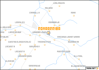
Roma Arriba (Libertador General Bernardo OʼHiggins, Chile)Roma Arriba is a town in the Libertador General Bernardo OʼHiggins region of Chile. An overview map of the region around Roma Arriba is displayed below.
regional and 3d topo map of Roma Arriba, Chile ::
Roma Arriba airports ::
The nearest airport is SCL - Santiago Arturo Merino Benitez Intl, located 136.4 km north of Roma Arriba.
Other airports nearby include LGS - Malargue (157.6 km south east), Nearby towns ::
La Javierana (1.9km north) //
Talcarehue (2.4km south east) //
Las Arboledas (3.1km west) //
Tres Puentes (4.0km south) //
Roma Abajo (4.0km north) //
La Mariñana (4.8km north east) //
Tinguiririca (5.9km south west) //
Centinela (6.1km west) //
Rincón de los Maturana (6.4km east) //
San Javier (7.2km south west) //
Puente Negro (8.7km south east) //
Cañadilla (8.7km north west) //
[all distances 'as the bird flies' and approximate] 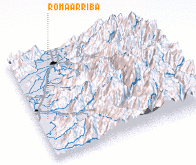 Places with similar names to Roma Arriba, Chile ::
// Rumah Rebai (MY)
// Rumah Ribai (MY)
Disclaimer :: Information on this page comes without warranty of any kind |
||
|
Where is Roma Arriba? Elevation and coordinates ::
Latitude (lat): 34°37'0"S Longitude (lon): 70°56'0"W
Elevation (approx.): 400m (map arrows pan, magnifying glasses zoom) |
||
|
Visiting Roma Arriba? Hotel/Accommodation ::
Book a hotel in Roma Arriba Travel Guide ::
Buy a travel guide for Chile rental cars ::
car rental offers GPS waypoint ::
download a GPX waypoint (PoI) of Roma Arriba for your GPS receiver
|
||