|
search place name
|
||
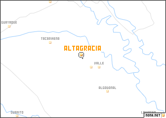
Altagracia (Departamento de Casanare, Colombia)Altagracia is a town in the Departamento de Casanare region of Colombia. An overview map of the region around Altagracia is displayed below.
regional and 3d topo map of Altagracia, Colombia ::
Altagracia airports ::
The nearest airport is TME - Tame, located 134.6 km north of Altagracia.
Other airports nearby include VVC - Villavicencio Vanguardia (201.8 km south west), BOG - Bogota Eldorado Intl (226.4 km west), BGA - Bucaramanga Palonegro (227.9 km north west), AUC - Arauca Santiago Perez (252.5 km north east), Nearby towns ::
Veladero (2.6km north west) //
Amparo (2.6km south east) //
Valle (4.1km south east) //
Tacarimena (8.3km north west) //
Algodonal (9.3km south east) //
[all distances 'as the bird flies' and approximate] 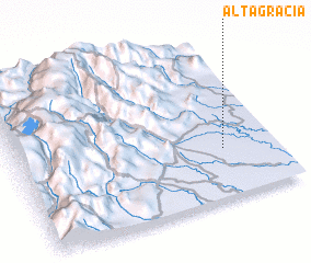 Places with similar names to Altagracia, Colombia ::
// Alta Gracia (BO)
// Alta Gracia (BO)
// Alta Gracia (BO)
// Alta Gracia (BO)
// Alta Gracia (BO)
// Altagracia (BO)
// Alte Kirche (DE)
// Altagracia (CU)
// Altagracia (CU)
// Altagracia (CU)
Disclaimer :: Information on this page comes without warranty of any kind |
||
|
Where is Altagracia? Elevation and coordinates ::
Latitude (lat): 5°19'0"N Longitude (lon): 72°12'0"W
Elevation (approx.): 207m (map arrows pan, magnifying glasses zoom) |
||
|
Visiting Altagracia? Hotel/Accommodation ::
Book a hotel in Altagracia Travel Guide ::
Buy a travel guide for Colombia rental cars ::
car rental offers GPS waypoint ::
download a GPX waypoint (PoI) of Altagracia for your GPS receiver
|
||