|
search place name
|
||
Antonio Garcia (Córdoba, Colombia)Antonio Garcia is a town in the Córdoba region of Colombia. An overview map of the region around Antonio Garcia is displayed below.
regional and 3d topo map of Antonio Garcia, Colombia ::

Antonio Garcia airports ::
The nearest airport is MTR - Monteria Los Garzones, located 56.7 km east of Antonio Garcia.
Other airports nearby include CZU - Corozal Las Brujas (127.1 km north east), MGN - Magangue Baracoa (170.8 km east), CTG - Cartagena Rafael Nunez (197.1 km north east), OTU - Otu (271.9 km south east), Nearby towns ::
Marcelino Reyes (0.3km south) //
Bernardo Reyes (2.8km west) //
Maria Santana (3.7km north west) //
Los Córdobas (4.9km north west) //
Garrapato (6.0km south west) //
Benito Navarro (6.5km north west) //
Manuel Pastrana (7.4km south east) //
La Caña (7.9km south) //
Dos Hermanos (8.3km west) //
Noriña (8.4km south east) //
Volcán (8.4km west) //
Puerto Rey (8.7km west) //
Coracas (8.8km west) //
San Felipe (9.3km north) //
Pasa Mona (9.4km south east) //
Juan Leon (10.7km south east) //
[all distances 'as the bird flies' and approximate] 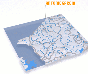 Places with similar names to Antonio Garcia, Colombia ::
// Antônio Garcia (BR)
Disclaimer :: Information on this page comes without warranty of any kind |
||
|
Where is Antonio Garcia? Elevation and coordinates ::
Latitude (lat): 8°51'37"N Longitude (lon): 76°20'23"W
Elevation (approx.): 71m (map arrows pan, magnifying glasses zoom) |
||
|
Visiting Antonio Garcia? Hotel/Accommodation ::
Book a hotel in Antonio Garcia Travel Guide ::
Buy a travel guide for Colombia rental cars ::
car rental offers GPS waypoint ::
download a GPX waypoint (PoI) of Antonio Garcia for your GPS receiver
|
||