|
search place name
|
||
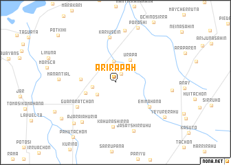
Arírapah (La Guajira, Colombia)Arírapah is a town in the La Guajira region of Colombia. An overview map of the region around Arírapah is displayed below.
regional and 3d topo map of Arírapah, Colombia ::
Arírapah airports ::
The nearest airport is RCH - Rio Hacha Almirante Padilla, located 51.4 km west of Arírapah.
Other airports nearby include MAR - Maracaibo La Chinita Intl (143.3 km south east), VUP - Valledupar Alfonso Lopez Pumarejo (157.3 km south west), SMR - Santa Marta Simon Bolivar (200.6 km west), Nearby towns ::
Tapáchaho (1.7km north east) //
Chalua (2.7km north) //
Chauainamahana (3.4km north) //
Kasíposh (3.5km south west) //
Maguasira (3.8km west) //
Urapa (4.3km north east) //
Mauáshirra (5.1km west) //
Camisamana (5.5km west) //
Emimahana (6.7km south east) //
Káhurashirra (7.2km south) //
Guararatchon (7.3km south west) //
Kariusein (7.4km north) //
Jasayshirruhu (8.4km south) //
Ajaraiahuria (8.4km south west) //
Sútsupana (8.6km north) //
Masharrerain (9.4km south west) //
Poroshi (9.5km north) //
Jeyúrerahu (9.7km south east) //
Yeyurerahu (9.7km south east) //
Kurisi (10.4km south west) //
Páhutachom (11.1km south west) //
[all distances 'as the bird flies' and approximate] 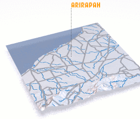
Disclaimer :: Information on this page comes without warranty of any kind |
||
|
Where is Arírapah? Elevation and coordinates ::
Latitude (lat): 11°37'43"N Longitude (lon): 72°27'59"W
Elevation (approx.): 25m (map arrows pan, magnifying glasses zoom) |
||
|
Visiting Arírapah? Hotel/Accommodation ::
Book a hotel in Arírapah Travel Guide ::
Buy a travel guide for Colombia rental cars ::
car rental offers GPS waypoint ::
download a GPX waypoint (PoI) of Arírapah for your GPS receiver
|
||