|
search place name
|
||
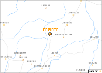
Corinto (Norte de Santander, Colombia)Corinto is a town in the Norte de Santander region of Colombia. An overview map of the region around Corinto is displayed below.
regional and 3d topo map of Corinto, Colombia ::
Corinto airports ::
The nearest airport is LFR - La Fria, located 54.5 km east of Corinto.
Other airports nearby include CUC - Cucuta Camilo Daza (56.2 km south east), OCV - Ocana Aguas Claras (67.9 km west), SVZ - San Antonio Del Tachira (68.4 km south east), STB - Santa Barbara Del Zulia (110.1 km north east), Nearby towns ::
San Martín de Loba (4.6km east) //
La Cruz (7.1km south) //
Las Brisas (7.2km north east) //
Campo Giles (11.3km north east) //
[all distances 'as the bird flies' and approximate] 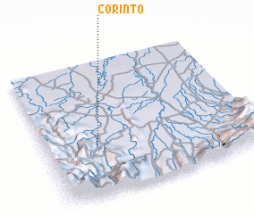 Places with similar names to Corinto, Colombia ::
Disclaimer :: Information on this page comes without warranty of any kind |
||
|
Where is Corinto? Elevation and coordinates ::
Latitude (lat): 8°22'45"N Longitude (lon): 72°44'42"W
Elevation (approx.): 278m (map arrows pan, magnifying glasses zoom) |
||
|
Visiting Corinto? Hotel/Accommodation ::
Book a hotel in Corinto Travel Guide ::
Buy a travel guide for Colombia rental cars ::
car rental offers GPS waypoint ::
download a GPX waypoint (PoI) of Corinto for your GPS receiver
|
||