|
search place name
|
||
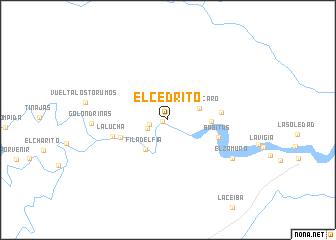
El Cedrito (Departamento de Arauca, Colombia)El Cedrito is a town in the Departamento de Arauca region of Colombia. An overview map of the region around El Cedrito is displayed below.
regional and 3d topo map of El Cedrito, Colombia ::
El Cedrito airports ::
The nearest airport is TME - Tame, located 67.9 km south of El Cedrito.
Other airports nearby include STD - Santo Domingo Mayor Buenaventura Vivas (70.8 km north west), AUC - Arauca Santiago Perez (100.7 km east), SVZ - San Antonio Del Tachira (123.2 km north west), CUC - Cucuta Camilo Daza (135.6 km north west), Nearby towns ::
Isla Burrigui (0.6km west) //
La Ceiba (2.1km west) //
Cascarón (2.4km south west) //
El Caracaro (3.7km east) //
Filadelfia (4.2km south west) //
La Pradera (4.8km east) //
Puerto Lleras (5.6km west) //
Babitas (5.9km east) //
Los Pájaros (5.9km east) //
La Lucha (6.4km west) //
El Zamuro (8.3km south east) //
Golondrinas (8.5km west) //
[all distances 'as the bird flies' and approximate] 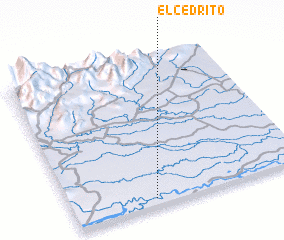 Places with similar names to El Cedrito, Colombia ::
// El Cedrito (CO)
// El Cedrito (CO)
// El Cedrito (MX)
// El Cedrito (MX)
// El Cedrito (MX)
// El Cedrito (MX)
// El Cedrito (MX)
// El Esterito (MX)
// El Cedrito (HN)
// El Cedrito (HN)
Disclaimer :: Information on this page comes without warranty of any kind |
||
|
Where is El Cedrito? Elevation and coordinates ::
Latitude (lat): 7°3'18"N Longitude (lon): 71°38'53"W
Elevation (approx.): 174m (map arrows pan, magnifying glasses zoom) |
||
|
Visiting El Cedrito? Hotel/Accommodation ::
Book a hotel in El Cedrito Travel Guide ::
Buy a travel guide for Colombia rental cars ::
car rental offers GPS waypoint ::
download a GPX waypoint (PoI) of El Cedrito for your GPS receiver
|
||