|
search place name
|
||
El Chuscal (Risaralda, Colombia)El Chuscal is a town in the Risaralda region of Colombia. An overview map of the region around El Chuscal is displayed below.
regional and 3d topo map of El Chuscal, Colombia ::

El Chuscal airports ::
The nearest airport is MZL - Manizales La Nubia, located 50.9 km south east of El Chuscal.
Other airports nearby include PEI - Pereira Matecana (64.3 km south), MDE - Rio Negro Jose Maria Cordova (92.4 km north east), EOH - Medellin Olaya Herrera (93.0 km north), AXM - Armenia El Eden (104.1 km south), Nearby towns ::
La Palma (1.5km south west) //
El Oro (1.7km north west) //
La Ceiba (2.5km south) //
El Llano (3.5km west) //
Pueblo Viejo (5.1km north east) //
Batero (5.1km south east) //
Barroblanco (5.2km south west) //
Llano Grande (5.3km south west) //
Cambía (5.3km north) //
Roble Bonito (5.3km north west) //
El Higo (5.4km south east) //
Santa Inés (5.5km north) //
Riosucio (5.6km north east) //
Tambora (5.8km south west) //
Quinchía (5.9km south) //
Bolívar (6.1km south) //
Miracampos (6.1km south east) //
Los Naranjos (6.3km south west) //
Marsella (6.4km north) //
La Serna (6.6km south west) //
Los Charcos (6.7km north) //
La Sirena (6.7km west) //
Murrapal (6.9km south) //
Insambra (7.0km south) //
Moreta (7.1km south east) //
Tumbarreto (7.3km north east) //
El Centradero (7.4km north) //
Sipirra (7.5km north east) //
Méjico (7.5km west) //
[all distances 'as the bird flies' and approximate] 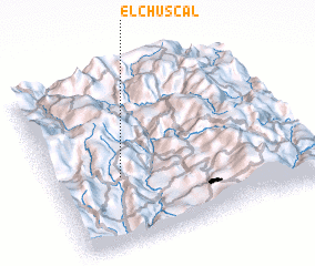 Places with similar names to El Chuscal, Colombia ::
// El Chuscal (CO)
// El Chuscal (CO)
Disclaimer :: Information on this page comes without warranty of any kind |
||
|
Where is El Chuscal? Elevation and coordinates ::
Latitude (lat): 5°23'38"N Longitude (lon): 75°44'44"W
Elevation (approx.): 2336m (map arrows pan, magnifying glasses zoom) |
||
|
Visiting El Chuscal? Hotel/Accommodation ::
Book a hotel in El Chuscal Travel Guide ::
Buy a travel guide for Colombia rental cars ::
car rental offers GPS waypoint ::
download a GPX waypoint (PoI) of El Chuscal for your GPS receiver
|
||