|
search place name
|
||
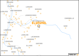
El Urumal (Santander, Colombia)El Urumal is a town in the Santander region of Colombia. An overview map of the region around El Urumal is displayed below.
regional and 3d topo map of El Urumal, Colombia ::
El Urumal airports ::
The nearest airport is BGA - Bucaramanga Palonegro, located 98.5 km north of El Urumal.
Other airports nearby include EJA - Barrancabermeja Yariguies (121.5 km north west), TME - Tame (142.0 km east), STD - Santo Domingo Mayor Buenaventura Vivas (182.2 km north east), SVZ - San Antonio Del Tachira (187.6 km north), Nearby towns ::
La Espumosa (0.9km south west) //
Antonia Santos (2.4km north) //
La Montana (2.5km north west) //
Penquefique (4.4km west) //
Gaona (5.1km west) //
Naranjal (5.1km west) //
Coromoro (5.3km north) //
La Carreña (5.4km south) //
Casa de Arcos (5.6km north west) //
El Hato (5.8km west) //
Cincelada (6.0km west) //
Los Arrayanes (6.6km north west) //
Caparosa (7.0km west) //
La Laguna (7.0km north) //
La Despensa (7.4km west) //
Las Moras (7.7km south west) //
San Antonio (7.9km north) //
Santa Clara (8.1km south west) //
Menempa (8.1km north) //
La Salina (8.1km south west) //
Guayana (8.4km south) //
Trompeto (8.5km west) //
Las Flores (8.9km west) //
Coromorito (9.3km west) //
Coromorito (9.3km west) //
Arbolsolo (9.6km south west) //
[all distances 'as the bird flies' and approximate] 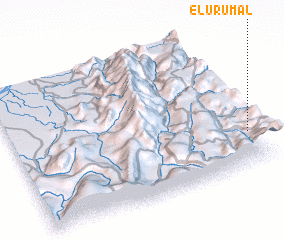 Places with similar names to El Urumal, Colombia ::
Disclaimer :: Information on this page comes without warranty of any kind |
||
|
Where is El Urumal? Elevation and coordinates ::
Latitude (lat): 6°14'58"N Longitude (lon): 73°1'39"W
Elevation (approx.): 1927m (map arrows pan, magnifying glasses zoom) |
||
|
Visiting El Urumal? Hotel/Accommodation ::
Book a hotel in El Urumal Travel Guide ::
Buy a travel guide for Colombia rental cars ::
car rental offers GPS waypoint ::
download a GPX waypoint (PoI) of El Urumal for your GPS receiver
|
||