|
search place name
|
||
Funes (Nariño, Colombia)Funes is a town in the Nariño region of Colombia. An overview map of the region around Funes is displayed below.
regional and 3d topo map of Funes, Colombia ::

Funes airports ::
The nearest airport is IPI - Ipiales San Luis, located 29.0 km south west of Funes.
Other airports nearby include TUA - Tulcan Teniente Coronel Luis A Mantilla (35.6 km south west), PSO - Pasto Antonio Narino (47.2 km north), PUU - Puerto Asis Tres De Mayo (119.0 km south east), OCC - Coca Francisco De Orellana (169.8 km south), Nearby towns ::
Fúnes (0.0km north) //
Pilcuán (4.1km north west) //
Santa Rosa (5.9km north) //
Guapuscal (6.7km north east) //
Inantas (7.4km north) //
San Mateo (7.6km south) //
Tasnaque (7.6km north) //
Ospina Pérez (7.9km south west) //
Chapal (7.9km south east) //
San Javier (8.3km west) //
Iles (8.8km west) //
Imués (8.9km north west) //
La Josefina (11.0km south west) //
[all distances 'as the bird flies' and approximate] 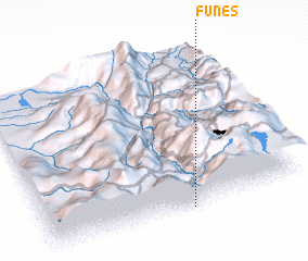 Places with similar names to Funes, Colombia ::
Disclaimer :: Information on this page comes without warranty of any kind |
||
|
Where is Funes? Elevation and coordinates ::
Latitude (lat): 1°0'0"N Longitude (lon): 77°27'0"W
Elevation (approx.): 2302m (map arrows pan, magnifying glasses zoom) |
||
|
Visiting Funes? Hotel/Accommodation ::
Book a hotel in Funes Travel Guide ::
Buy a travel guide for Colombia rental cars ::
car rental offers GPS waypoint ::
download a GPX waypoint (PoI) of Funes for your GPS receiver
|
||