|
search place name
|
||
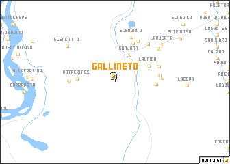
Gallineto (Santander, Colombia)Gallineto is a town in the Santander region of Colombia. An overview map of the region around Gallineto is displayed below.
regional and 3d topo map of Gallineto, Colombia ::
Gallineto airports ::
The nearest airport is EJA - Barrancabermeja Yariguies, located 81.8 km north east of Gallineto.
Other airports nearby include OTU - Otu (82.1 km north west), MDE - Rio Negro Jose Maria Cordova (133.2 km west), BGA - Bucaramanga Palonegro (140.6 km north east), EOH - Medellin Olaya Herrera (150.2 km west), Nearby towns ::
El Tesoro (2.5km north west) //
San Juan (5.0km north east) //
La Unión (6.1km north east) //
Potreritos (6.2km west) //
Porvenir (6.7km east) //
La Porfia (7.0km north east) //
Guadualito (7.3km east) //
Marquetalia (7.5km west) //
El Balsamo (7.6km north east) //
La Ilusión (7.6km east) //
El Engaño (7.8km north) //
Bellavista (7.8km east) //
Tabatinga (8.2km north east) //
San Bernardo (8.9km north east) //
El Encanto (9.8km north west) //
La Huerta (9.8km north east) //
[all distances 'as the bird flies' and approximate] 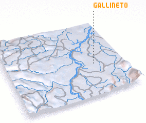 Places with similar names to Gallineto, Colombia ::
Disclaimer :: Information on this page comes without warranty of any kind |
||
|
Where is Gallineto? Elevation and coordinates ::
Latitude (lat): 6°25'54"N Longitude (lon): 74°14'59"W
Elevation (approx.): 125m (map arrows pan, magnifying glasses zoom) |
||
|
Visiting Gallineto? Hotel/Accommodation ::
Book a hotel in Gallineto Travel Guide ::
Buy a travel guide for Colombia rental cars ::
car rental offers GPS waypoint ::
download a GPX waypoint (PoI) of Gallineto for your GPS receiver
|
||