|
search place name
|
||
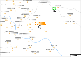
Guamal (Caldas, Colombia)Guamal is a town in the Caldas region of Colombia. An overview map of the region around Guamal is displayed below.
regional and 3d topo map of Guamal, Colombia ::
Guamal airports ::
The nearest airport is MZL - Manizales La Nubia, located 11.3 km north east of Guamal.
Other airports nearby include PEI - Pereira Matecana (28.2 km south west), AXM - Armenia El Eden (60.9 km south west), IBE - Ibague Perales (72.3 km south east), ULQ - Tulua Farfan (123.5 km south west), Nearby towns ::
La Telaraña (2.0km south east) //
La Zulia (2.9km south east) //
Alto Villaraso (4.6km north west) //
Ríoclaro (4.8km north west) //
El Yarumo (4.9km west) //
Chuscal (5.1km west) //
Miraflores (5.3km north west) //
Llanitos (5.4km north) //
Pinares (6.1km west) //
Alto de La Cruz (6.3km west) //
Yarumal (6.3km south west) //
Santa Rita (8.0km south west) //
Santa Bárbara (8.0km south west) //
Naranjo (9.3km north west) //
La Violeta (9.3km north west) //
Obito (10.1km south west) //
Dabeiba (10.8km south east) //
Las Pavas (11.1km north west) //
[all distances 'as the bird flies' and approximate]  Places with similar names to Guamal, Colombia ::
Disclaimer :: Information on this page comes without warranty of any kind |
||
|
Where is Guamal? Elevation and coordinates ::
Latitude (lat): 4°56'45"N Longitude (lon): 75°31'22"W
Elevation (approx.): 2012m (map arrows pan, magnifying glasses zoom) |
||
|
Visiting Guamal? Hotel/Accommodation ::
Book a hotel in Guamal Travel Guide ::
Buy a travel guide for Colombia rental cars ::
car rental offers GPS waypoint ::
download a GPX waypoint (PoI) of Guamal for your GPS receiver
|
||