|
search place name
|
||
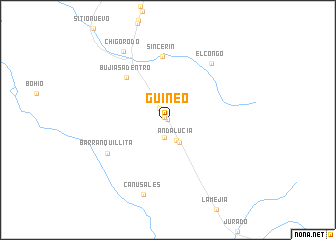
Guineo (Antioquia, Colombia)Guineo is a town in the Antioquia region of Colombia. An overview map of the region around Guineo is displayed below.
regional and 3d topo map of Guineo, Colombia ::
Guineo airports ::
The nearest airport is MTR - Monteria Los Garzones, located 161.8 km north east of Guineo.
Other airports nearby include BSC - Bahia Solano Jose Celestino Mutis (176.2 km south west), EOH - Medellin Olaya Herrera (192.5 km south east), MDE - Rio Negro Jose Maria Cordova (208.9 km south east), UIB - Quibdo El Carano (212.0 km south), Nearby towns ::
La Gitana (0.0km north west) //
Las Hamacas (0.5km north west) //
Calamar (1.6km north west) //
Rancho Grande (2.0km south) //
Andalucía (2.5km south) //
El Venado (2.6km north west) //
El Tigre (2.8km south east) //
Bujías Adentro (6.5km north west) //
Sincerín (7.1km north) //
Barranquillita (7.7km south west) //
El Congo (7.9km north east) //
Cañusales (8.7km south) //
Chigorodó (9.1km north west) //
[all distances 'as the bird flies' and approximate]  Places with similar names to Guineo, Colombia ::
Disclaimer :: Information on this page comes without warranty of any kind |
||
|
Where is Guineo? Elevation and coordinates ::
Latitude (lat): 7°36'28"N Longitude (lon): 76°38'31"W
Elevation (approx.): 44m (map arrows pan, magnifying glasses zoom) |
||
|
Visiting Guineo? Hotel/Accommodation ::
Book a hotel in Guineo Travel Guide ::
Buy a travel guide for Colombia rental cars ::
car rental offers GPS waypoint ::
download a GPX waypoint (PoI) of Guineo for your GPS receiver
|
||