|
search place name
|
||
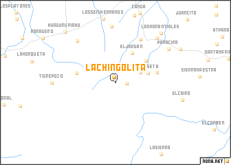
La Chingolita (La Guajira, Colombia)La Chingolita is a town in the La Guajira region of Colombia. An overview map of the region around La Chingolita is displayed below.
regional and 3d topo map of La Chingolita, Colombia ::
La Chingolita airports ::
The nearest airport is RCH - Rio Hacha Almirante Padilla, located 72.4 km north west of La Chingolita.
Other airports nearby include MAR - Maracaibo La Chinita Intl (96.9 km south east), VUP - Valledupar Alfonso Lopez Pumarejo (121.4 km south west), SMR - Santa Marta Simon Bolivar (200.6 km west), VLV - Valera Dr Antonio Nicolas Briceno (280.6 km south east), Nearby towns ::
El Milagro (1.8km east) //
San Martín (4.3km east) //
El Jordán (5.4km north east) //
La Meseta (5.4km east) //
Carorones (6.0km north east) //
Corazonal (6.4km west) //
Las Vistas (6.8km east) //
Los Paraujanos (8.0km north east) //
Karalouptamahana (9.1km north west) //
Caño Seco (9.8km north east) //
Pañacira (10.0km north east) //
Los Manantiales (10.8km north east) //
Huadurupiahú (11.5km north west) //
[all distances 'as the bird flies' and approximate]  Places with similar names to La Chingolita, Colombia :: Disclaimer :: Information on this page comes without warranty of any kind |
||
|
Where is La Chingolita? Elevation and coordinates ::
Latitude (lat): 11°8'6"N Longitude (lon): 72°23'40"W
Elevation (approx.): 467m (map arrows pan, magnifying glasses zoom) |
||
|
Visiting La Chingolita? Hotel/Accommodation ::
Book a hotel in La Chingolita Travel Guide ::
Buy a travel guide for Colombia rental cars ::
car rental offers GPS waypoint ::
download a GPX waypoint (PoI) of La Chingolita for your GPS receiver
|
||