|
search place name
|
||
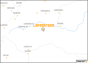
La Frontera (Meta, Colombia)La Frontera is a town in the Meta region of Colombia. An overview map of the region around La Frontera is displayed below.
regional and 3d topo map of La Frontera, Colombia ::
La Frontera airports ::
The nearest airport is VVC - Villavicencio Vanguardia, located 104.0 km west of La Frontera.
Other airports nearby include SJE - San Jose Del Guaviare Jorge E Gonzalez Torres (159.1 km south), BOG - Bogota Eldorado Intl (178.6 km north west), Nearby towns ::
Florida (1.6km north west) //
Las Dos Eses (6.5km west) //
Tesoro (7.4km east) //
Primavera (7.7km north) //
La Soberana (8.5km north) //
La Bermeja (8.9km west) //
Yucalito (10.1km south west) //
La Mansión (10.1km north east) //
[all distances 'as the bird flies' and approximate] 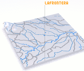 Places with similar names to La Frontera, Colombia ::
// La Frontera (CU)
// La Frontera (ES)
// Lavarindroy (MG)
// La Frontera (CO)
// La Frontera (CO)
// La Frontera (CO)
// La Frontera (CO)
// La Frontera (CO)
// La Frontera (CO)
// La Frontera (CO)
Disclaimer :: Information on this page comes without warranty of any kind |
||
|
Where is La Frontera? Elevation and coordinates ::
Latitude (lat): 4°1'4"N Longitude (lon): 72°41'21"W
Elevation (approx.): 218m (map arrows pan, magnifying glasses zoom) |
||
|
Visiting La Frontera? Hotel/Accommodation ::
Book a hotel in La Frontera Travel Guide ::
Buy a travel guide for Colombia rental cars ::
car rental offers GPS waypoint ::
download a GPX waypoint (PoI) of La Frontera for your GPS receiver
|
||