|
search place name
|
||
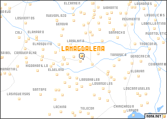
La Magdalena (Cesar, Colombia)La Magdalena is a town in the Cesar region of Colombia. An overview map of the region around La Magdalena is displayed below.
regional and 3d topo map of La Magdalena, Colombia ::
La Magdalena airports ::
The nearest airport is MGN - Magangue Baracoa, located 104.2 km west of La Magdalena.
Other airports nearby include OCV - Ocana Aguas Claras (130.4 km south east), VUP - Valledupar Alfonso Lopez Pumarejo (138.4 km north east), CZU - Corozal Las Brujas (152.2 km west), BAQ - Barranquilla Ernesto Cortissoz (194.5 km north west), Nearby towns ::
La Vena (0.8km south west) //
Mandinguilla (2.2km south east) //
Tres Esquinas (2.3km west) //
La Palmita (3.5km north west) //
Corral La Conquista (3.5km east) //
El Abanico (3.7km west) //
Lo Verán (4.2km west) //
La Guamalera (4.4km south) //
El Tesoro (4.4km north west) //
El Carmen (4.5km west) //
El Cerrito (4.8km south west) //
Jerusalén (4.8km west) //
La Riña (5.0km south west) //
La Reforma (5.6km south) //
Santa Fe (5.6km west) //
La Asamblea (5.8km south) //
El Canal (5.9km north) //
El Palmar (5.9km north east) //
Las Margaritaso (6.0km north) //
Buenos Aires (6.1km south) //
El Bálsamo (6.1km south east) //
Los Negros (6.2km south east) //
Palmira (6.4km north) //
El Cascajo (6.4km north west) //
Santa Isabel (6.4km west) //
La Camorra (6.6km south west) //
El Tesoro (6.7km west) //
La Cira (6.8km south west) //
El Delirio (6.9km south west) //
[all distances 'as the bird flies' and approximate]  Places with similar names to La Magdalena, Colombia ::
// La Magdalena (CU)
// La Magdalena (CU)
// La Magdalena (CU)
// La Magdalena (ES)
// La Magdalena (ES)
// La Magdalena (ES)
// La Magdalena (ES)
// La Magdalena (ES)
// La Magdalena (ES)
// La Magdalena (CO)
Disclaimer :: Information on this page comes without warranty of any kind |
||
|
Where is La Magdalena? Elevation and coordinates ::
Latitude (lat): 9°21'47"N Longitude (lon): 73°54'2"W
Elevation (approx.): 54m (map arrows pan, magnifying glasses zoom) |
||
|
Visiting La Magdalena? Hotel/Accommodation ::
Book a hotel in La Magdalena Travel Guide ::
Buy a travel guide for Colombia rental cars ::
car rental offers GPS waypoint ::
download a GPX waypoint (PoI) of La Magdalena for your GPS receiver
|
||