|
search place name
|
||
Las Águilas (Norte de Santander, Colombia)Las Águilas is a town in the Norte de Santander region of Colombia. An overview map of the region around Las Águilas is displayed below.
regional and 3d topo map of Las Águilas, Colombia ::

Las Águilas airports ::
The nearest airport is OCV - Ocana Aguas Claras, located 33.3 km south of Las Águilas.
Other airports nearby include CUC - Cucuta Camilo Daza (120.6 km south east), LFR - La Fria (127.0 km east), SVZ - San Antonio Del Tachira (132.9 km south east), STB - Santa Barbara Del Zulia (160.9 km east), Nearby towns ::
El Cobre (2.3km south west) //
El Espejo (2.8km south) //
Miraflores (3.7km south east) //
Mesa Rica (3.8km east) //
San José (4.0km north east) //
Bellaluz (4.3km south) //
Campoalegre (4.7km east) //
Gramales (5.1km south) //
El Cobre (5.2km east) //
San José de Las Pitas (6.3km north east) //
La Hoyada (6.5km west) //
Las Vegas (6.9km north) //
Culebrita (7.7km west) //
Cartagena (8.3km south) //
Balcanes (8.6km south) //
La Trinidad (8.8km north west) //
Brisas (8.9km west) //
Pajitas (9.3km north west) //
Retiro (9.9km south east) //
Maracaibo (11.0km south west) //
[all distances 'as the bird flies' and approximate] 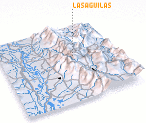 Places with similar names to Las Águilas, Colombia ::
// Los Agallos (PA)
// Los Callos (CU)
// Los Quiles (ES)
// Las Gualas (CL)
// Las Quilas (CL)
// Las Quilas (CL)
// Las Quilas (CL)
// Los Quilos (CL)
// Las Aguilas (CO)
// Las Águilas (CO)
Disclaimer :: Information on this page comes without warranty of any kind |
||
|
Where is Las Águilas? Elevation and coordinates ::
Latitude (lat): 8°36'59"N Longitude (lon): 73°21'38"W
Elevation (approx.): 1302m (map arrows pan, magnifying glasses zoom) |
||
|
Visiting Las Águilas? Hotel/Accommodation ::
Book a hotel in Las Águilas Travel Guide ::
Buy a travel guide for Colombia rental cars ::
car rental offers GPS waypoint ::
download a GPX waypoint (PoI) of Las Águilas for your GPS receiver
|
||