|
search place name
|
||
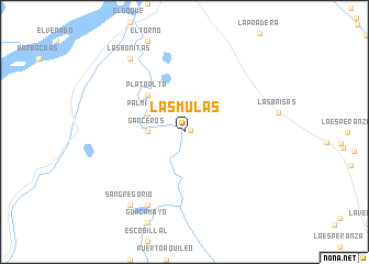
Las Mulas (Santander, Colombia)Las Mulas is a town in the Santander region of Colombia. An overview map of the region around Las Mulas is displayed below.
regional and 3d topo map of Las Mulas, Colombia ::
Las Mulas airports ::
The nearest airport is EJA - Barrancabermeja Yariguies, located 50.4 km north east of Las Mulas.
Other airports nearby include OTU - Otu (82.0 km north west), BGA - Bucaramanga Palonegro (110.8 km north east), MDE - Rio Negro Jose Maria Cordova (159.4 km west), EOH - Medellin Olaya Herrera (175.2 km west), Nearby towns ::
Puerto Parra (0.7km east) //
Garceros (3.7km west) //
Palmarito (4.1km north west) //
Plata Alta (5.2km north west) //
Fundación (8.3km south west) //
Las Bonitas (9.2km north west) //
San Gregorio (9.2km south west) //
[all distances 'as the bird flies' and approximate] 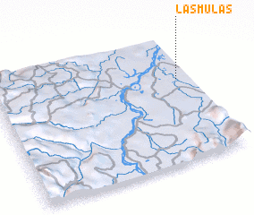 Places with similar names to Las Mulas, Colombia ::
// Las Mieles (PA)
// Las Mieles (PA)
// Las Mulas (PA)
// Las Mulas (CU)
// Las Mulas (CU)
// Las Mulas (CU)
// Las Mallas (ES)
// Las Muelas (CO)
// Las Mulas (CO)
// Los Mieles (EC)
Disclaimer :: Information on this page comes without warranty of any kind |
||
|
Where is Las Mulas? Elevation and coordinates ::
Latitude (lat): 6°39'0"N Longitude (lon): 74°4'0"W
Elevation (approx.): 93m (map arrows pan, magnifying glasses zoom) |
||
|
Visiting Las Mulas? Hotel/Accommodation ::
Book a hotel in Las Mulas Travel Guide ::
Buy a travel guide for Colombia rental cars ::
car rental offers GPS waypoint ::
download a GPX waypoint (PoI) of Las Mulas for your GPS receiver
|
||