|
search place name
|
||
Las Palmitas (Córdoba, Colombia)Las Palmitas is a town in the Córdoba region of Colombia. An overview map of the region around Las Palmitas is displayed below.
regional and 3d topo map of Las Palmitas, Colombia ::

Las Palmitas airports ::
The nearest airport is MTR - Monteria Los Garzones, located 19.3 km west of Las Palmitas.
Other airports nearby include CZU - Corozal Las Brujas (69.0 km north east), MGN - Magangue Baracoa (102.0 km north east), CTG - Cartagena Rafael Nunez (179.5 km north), OTU - Otu (225.7 km south east), Nearby towns ::
Rosa Vieja (2.5km north east) //
La Unión (5.1km south) //
Remedia Pobres (5.7km south west) //
La Palma (6.1km south west) //
El Damasco (6.1km south west) //
San Carlos (6.3km south west) //
Lamedero (6.5km south) //
Ciénaga de Oro (6.6km north east) //
Cabuya (7.3km west) //
La Poza (7.6km north east) //
Cabuya (7.8km west) //
El Llano (8.3km south east) //
Barrio Prieto (8.3km east) //
El Curial (8.3km east) //
Las Migas (8.4km south west) //
Los Ángeles (8.4km west) //
Berástegui (8.5km north west) //
Arena (8.6km north east) //
Santa Rosa (9.0km south) //
Papayal (9.2km south east) //
La Mina (10.1km south east) //
El Bobo (11.9km north east) //
[all distances 'as the bird flies' and approximate] 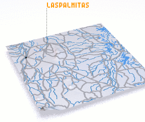 Places with similar names to Las Palmitas, Colombia ::
// Las Palmitas (PA)
// Las Palmitas (PA)
// Las Palmitas (CO)
// Las Palmitas (CO)
// Las Palmitas (CO)
// Las Palmitas (CO)
// Las Palmitas (CO)
// Las Palmitas (CO)
// Los Palmitos (CO)
// Los Palmitos (CO)
Disclaimer :: Information on this page comes without warranty of any kind |
||
|
Where is Las Palmitas? Elevation and coordinates ::
Latitude (lat): 8°49'31"N Longitude (lon): 75°39'3"W
Elevation (approx.): 12m (map arrows pan, magnifying glasses zoom) |
||
|
Visiting Las Palmitas? Hotel/Accommodation ::
Book a hotel in Las Palmitas Travel Guide ::
Buy a travel guide for Colombia rental cars ::
car rental offers GPS waypoint ::
download a GPX waypoint (PoI) of Las Palmitas for your GPS receiver
|
||